Add your own picture and explain the route, parking, gates, paths or landmarks that help people find it.
Earn 5 points after the picture is checked and accepted.
Add your photo and local directionsShare what you foundWhat is recorded here
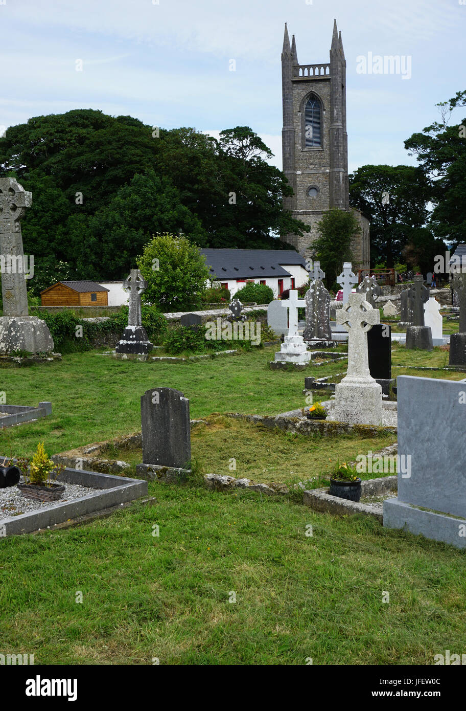
Situated on a slight rise of ground in the centre of Terryglass village. An early Christian monastery was founded in Terryglass by St Columb (Colum Mac Cremthainn) in the sixth century (Gwynn and Hadcock 1970, 45). Columb died around AD 552 (Ann. Inisf. 552). The church of Tirdaglassoe contributed three marks in the taxation of the diocese in 1302-7 (Cal. doc. Ire., 302). The Royal Visitation of 1615 described the church as having a 'covered chancell' (Murphy 1914, 221) but there is no mention of the church itself in the Civil Survey of 1654-6 where it only mentions the 'church yard of Tirraglasse' (Simington 1931, 311). According to local tradition the site of the monastery lies in the present church and graveyard (Carey and Farrelly 1994, 78). The ecclesiastical complex consists of a church (TN006-003003-), a graveyard (TN006-003008) and a holy well (TN006-003005-), all of which are situated within a possible ecclesiastical enclosure (TN006-003002-). Also sited within this possible enclosure are a bawn wall (TN006-003004-) immediately E of the church and graveyard and a linear earthwork (TN006-003006-) to the N.
The nave and chancel parish church (int. dims. L 12.6m N-S; 9.4m E-W; wall T 0.78m) forms the N boundary wall of the graveyard immediately SE of the disused St Columba's C of I church. The N wall of the nave is the best preserved standing to full height with the lower walls of the W gable and E gable upstanding where they have been reused as the boundary wall oft he graveyard (Carey and Farrelly 1994, 79). The walls are constructed from roughly coursed rubble limestone some of which are cyclopean in appearance supported by an external plinth. A blocked up doorway is visible in the centre of the W wall of the nave, with a skewput stone visible on NW angle of church. A blocked up doorway or archway is visible in centre of N wall of nave. The short wall return of the destroyed chancel arch is visible at E end of N wall of nave. A single splay of a destroyed window in the N wall of the chancel can be seen immediately to E of this dividing wall. The N and E wall of the chancel have been reused as the enclosing wall of the graveyard.
In 1840 the church was in poor condition, only the pointed chancel arch survived as well as the N and W gable of the nave, the latter being surmounted by a belfry (O'Flanagan 1930, vol. 2, 26-7). The W gable collapsed in the 1960s (Carey and Farrelly 1994, 80). The lower section of a blocked doorway is visible in centre of the W gable (Killanin and Duignan 1967, 402). Remains of a piscina are located on top of a wall between the church and the bawn (TN006-003004-), forming part of the crenellations. A carved stone decorated with a cross motif in diaper pattern and found during demolition of the surrounding graveyard wall may have been part of an eleventh/twelfth century doorway (Harbison 1967, 108-11). This carved stone is now housed in the Hunt Museum, Limerick (Ref. No. 0000.0416). Harbison suggested that the church may have been pre-Norman in date with a pointed window inserted in the E wall in the fourteenth century (ibid., 108).
The above description is derived from 'The Archaeological Inventory of County Tipperary. Vol. 1 - North Tipperary' compiled by Jean Farrelly and Caimin O'Brien (Dublin: Stationery Office, 2002). In certain instances the entries have been revised and updated in the light of recent research.
Date of upload/revision: 22 September 2008
The monument record does not grant public access. Check the route and ask the landowner before entering private land.