Add your own picture and explain the route, parking, gates, paths or landmarks that help people find it.
Earn 5 points after the picture is checked and accepted.
Add your photo and local directionsShare what you foundWhat is recorded here
In a slight fold on the S-facing slope of Rachcroghan ridge. Named 'Relig na Riogh' and described as a cemetery by Charles O'Conor of Belanagare (1753, 129), this identification was followed by J. O'Donovan in 1837 who described it as the Royal Cemetery of Connaught (O'Flanagan 1931, vol. 1, 85), and others (Gormely 1989, 10). Investigations of the interior had been undertaken by Charles O'Conor of Mount Allen c. 1830 when the souterrain (RO022-057036-) was opened, and later investigations conducted in 1913 when the remains of post-medieval houses were uncovered demonstrating that it was not a cemetery (Macalister 1928, 179).
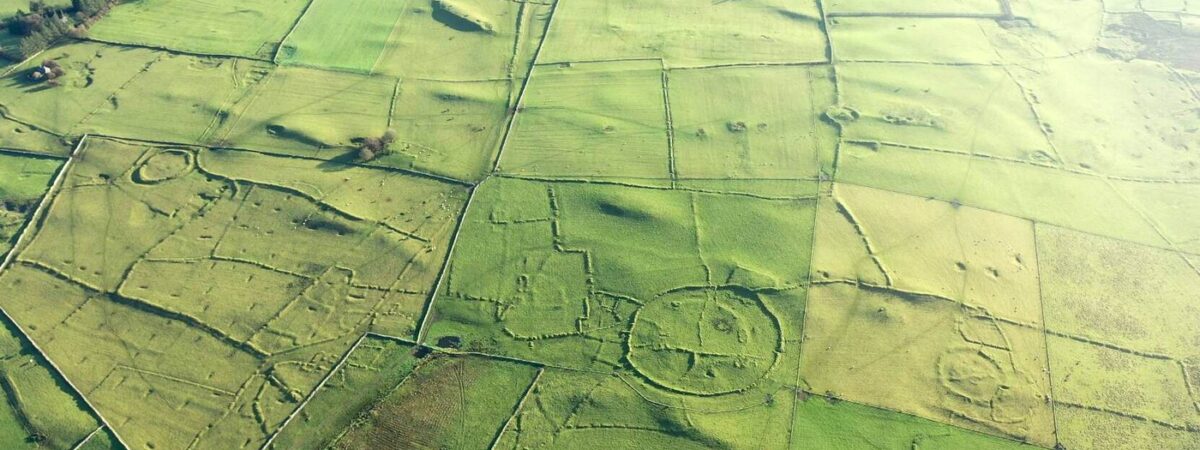
Circular grass-covered area (int. diam. 102m N-S; 99m E-W) defined by a stone spread (Wth 2-5m; H 0.4-1m) with internal and external facing-stones sometimes visible (original Wth c. 1.5m), and an outer fosse (Wth of top 4m; D 0.6m) SW-NW. There is a raised central platform (diam. 65m N-S), perhaps the remains of a rath (RO022-057077-), defined by a scarp (H 0.3-0.5m) N-S-W, with the entrance to souterrain (RO022-057036-) in the scarp at W. There is no identifiable entrance to either enclosure.
A rectangular enclosure or annexe (RO022-057038-) (dims 27.5m NE-SW; 17.7m NW-SE) defined by scarps (H 0.3-0.8m) is situated on a slight height and attached to the outside of the outer enclosure at SE, but its perimeter at SW is overlain by a N-S field bank. There is a rectangular house site (RO022-057037-) (int. dims 10.6m E-W; 4m N-S) on the perimeter of the inner enclosure at W. Other house sites were investigated in 1913 (Waddell 1983, 26). The site is overlain by N-S and E-W field banks of the field system (RO022-057003-), and cashel (RO022-057039-) is c. 100m to the S. (Knox 1914a, 35-6; Herity 1983, 132, Glenballythomas 25; Waddell 1983, 29-31; 1988, 8-10, No. 13)
This is a National Monument in state ownership: No. 473
See the attached aerial taken image from the NNE.
Compiled by: Michael Moore
Date of upload: 24 August 2010
The monument record does not grant public access. Check the route and ask the landowner before entering private land.