Add your own picture and explain the route, parking, gates, paths or landmarks that help people find it.
Earn 5 points after the picture is checked and accepted.
Add your photo and local directionsShare what you foundWhat is recorded here
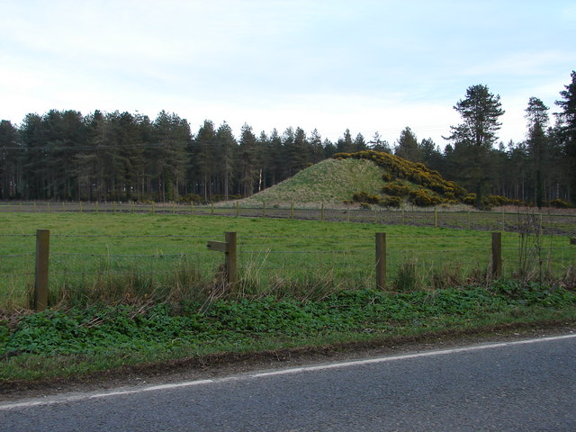
Flat topped mound (8m E-W, 8.50m N-S, H c. 5m, max basal diam. c. 27m)in prominent position, remains of ditch at S, SW and E situated 3m out from base of mound, may be of fairly recent origin. Burial ground and possible church site (OF012-005001-) lies just to the W.
Located on top of Drumcooly Hill with good extensive views and nearby burial ground and church site (OF012-005001-) to the E with ballykilleen multi-ramparted ringfort (OF011-035----) visible to the S. The site consists of a circular flat topped mound (H 3.9m; diam top 8m; base diam 27m) enclosed by a partially filled in fosse (Wth 1.5m; D 0.5m) visible from E to S only with attached D-shaped Bailey (100m E-W; 50m N-S) enclosed by an earthen bank (Wth 3.5m; ext. H 1.5m; int. H 1m). A modern feature to the site was the construction of a water tower within the bailey to the W of the motte. It may have been during its construction that the fosse was filled in. Another alteration to the site seems to have been the building of a road to the S of the motte which clips the S bank of the bailey. Prior to the construction of this road the bailey may have extended further S to encompass the top of Drumcooly hill. The bailey is depicted as being circular on the first edition of the OS 6-inch map before later road alterations. The faint outline of the levelled bailey can still be seen in the field to the S of the public road.
The above description is derived from the published 'Archaeological Inventory of County Offaly' (Dublin: Stationery Office, 1997). In certain instances the entries have been revised and updated in the light of recent research.
Date of upload: 23 May 2011
The monument record does not grant public access. Check the route and ask the landowner before entering private land.