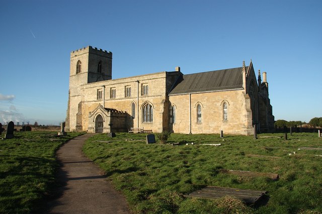
Add your own picture and explain the route, parking, gates, paths or landmarks that help people find it.
Earn 5 points after the picture is checked and accepted.
Add your photo and local directionsShare what you foundWhat is recorded here
The possible site of a fifth century church founded by Bishop Mac Caille once stood inside a walled graveyard on the E shoulder of Croghan Hill, 150m E of the prehistoric burial mound (OF010-004001-). Bishop Mac Caille was reputedly the nephew of St. Patrick as he was the son of Darerca, sister of Patrick (O’Donovan 1856, 152). The Calendar of Cashel recorded that his feast day was held on the 25th of April at ‘Cruach-an-Bri-Eile’ [Croghan Hill]. According to the seventh century historian Tíreachán, it was Mac Caille who presented Brighid of Kildare with her veil (Ó Riain 2011, 412). This monastic story created a link between this church site and the monastery of Brighid in Kildare although later Patrician historians created a link between Mac Caille and Patrick and called him ‘Patrick’s bishop’ (ibid.). The church stands today on the border of the parish of Croghan in the diocese of Kildare. A meandering curving earthwork visible on aerial photographs 40m E of the graveyard marks the parish boundary with Ballyburly. Rohan (2005) suggested that the curving section of bank located to the E of the graveyard may represent the partial remains of the vallum of an early Christian monastic enclosure. Well preserved broad cultivation ridges of uncertain date can be seen in the fields surrounding the graveyard.
A church is marked on the 1838 edition of the OS 6-inch map as Bishop Mac Caille's Church where it is located in the NW corner of the graveyard. In 1838 no part of the church was visible however local people remembered ‘twelve feet [4m] of the walls standing’ (Herity 2008, 42). In 1916 it was recorded that a small platform in NW quadrant of the graveyard probably represented the site of this church (Fitzgerald 1917, 384-5). Today there are no surface remains visible of any church inside the square-shaped graveyard which was enclosed by a stone wall in the 1860s. According to the 1934 National Schools Survey of Holy Wells, during the digging of the foundations for this graveyard wall the mason employed came across the foundations of a building which he believed to be the remains of Bishop Mac Caille's Church (National Folklore Dept. UCD, NFC 468, 135). The graveyard contains numerous stone memorials dating from the 19th century. Local folklore recorded the following tradition in 1938; ‘when the people were burying a person they used to go round the Graveyard with the coffin three times before they would go in to bury it’ (The Schools’ Collection, Volume 0803, Page 329). The church uncovered in these sources may have been the remains of a medieval chapel of ease or a monastic stone church of pre-Norman date.
The above description is derived from the published 'Archaeological Inventory of County Offaly' (Dublin: Stationery Office, 1997). In certain instances the entries have been revised and updated in the light of recent research.
Compiled and revised by: Caimin O'Brien
Date of upload/revision: 18 September 2018
The monument record does not grant public access. Check the route and ask the landowner before entering private land.