Add your own picture and explain the route, parking, gates, paths or landmarks that help people find it.
Earn 5 points after the picture is checked and accepted.
Add your photo and local directionsShare what you foundWhat is recorded here
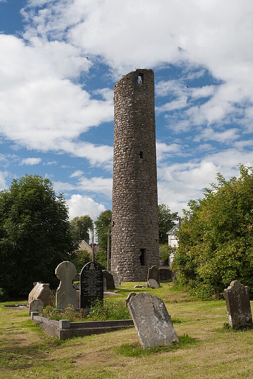
Situated towards the bottom of a S-facing slope, and incorporated into the perimeter of the graveyard (MO011-010003-) at W. The doorway and lights are completely plain with simple lintels, suggesting an early date. The lintelled and battered doorway, which entered at the first floor, is c. 1.5m the level of the graveyard and faces E. At this level the floor of the tower (int. diam. 2.7m; ext. diam. c. 4.9m) was supported on rebates but above this three floors were supported only partly on offsets and partly on beams set into the walls. The tower survives to the level of the cap (H c. 23m), which is missing. The interior was cleared of rubble in the 1840s when two archaeological floors, the lower with mortar, were noted. Beneath the mortar was a jumble of inhumed remains, undoubtedly disturbed in building the tower from a pre-existing cemetery. Archaeological testing (01E0879) c. 30m W of the round tower produced no related material (Clarke 2003) and further testing (05E0251) c. 35m SW of the tower had a similar negative result (McLoughlin, 2008). (Wakeman 1875, 329-32; Barrow 1979, 171-2)
Compiled by: Michael Moore
This is a National Monument in state ownership: No. 111
See the attached views: _1 aerial from NW; _2 from NE; _3 doorway
Date of revised upload: 29 November 2016
Amended: 13 January 2020
The monument record does not grant public access. Check the route and ask the landowner before entering private land.