Add your own picture and explain the route, parking, gates, paths or landmarks that help people find it.
Earn 5 points after the picture is checked and accepted.
Add your photo and local directionsShare what you foundWhat is recorded here
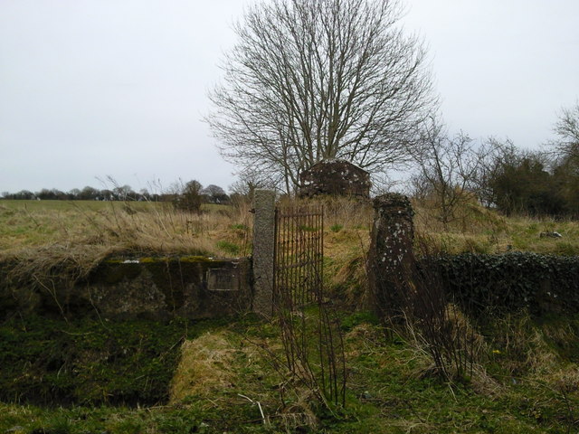
The parish church of Rathregan is located at the crest of a NE-facing slope down to the NW-SE Tolka River, which is c. 80m to the NE and close to its source. A church at Rathregan is listed in the ecclesiastical taxation (1302-06) of Pope Nicholas IV (Cal. doc. Ire., 5, 254). The rectory of Rathregan was amongst the possessions of the Augustinian priory at Newtown (ME036-049003-) at its suppression in 1540 (White 1943, 296). Ussher (1622) describes the church and chancel at Rathreggan as ruined (Erlington 1847-64, 1, lxx). According to Dopping’s visitation (1682-5) the church of the Blessed Virgin Mary had been unroofed since 1641 but the walls were standing and the graveyard was not enclosed (Ellison 1971, 38). According to Cogan (1862-70, vol. 2, 360-1) the church measured ’74 feet by 18 feet (c. 22.55m x c. 5.5m). The foundations (Wth 0.9m; H 0.4- 1.4m) of a rectangular nave (int. dims c. 14m E-W; 5.5m N-S) and a possible chancel (int. dim c. 7m E-W) survive in a neglected D-shaped graveyard (dims. c. 48m NE-SW; c. 40m NW-SE) defined by masonry walls with straight sides at the SW and NW sides. There is a roadway outside the perimeter SE-SW, and the few headstones date from c. 1850 to c. 1940. The rath (WM044-020----) is c. 60m to the NNW.
The above description is derived from the published 'Archaeological Inventory of County Meath' (Dublin: Stationery Office, 1987). In certain instances the entries have been revised and updated in the light of recent research.
Compiled by: Michael Moore
Date of upload/revision: 7 April, 2015
The monument record does not grant public access. Check the route and ask the landowner before entering private land.