Add your own picture and explain the route, parking, gates, paths or landmarks that help people find it.
Earn 5 points after the picture is checked and accepted.
Add your photo and local directionsShare what you foundWhat is recorded here
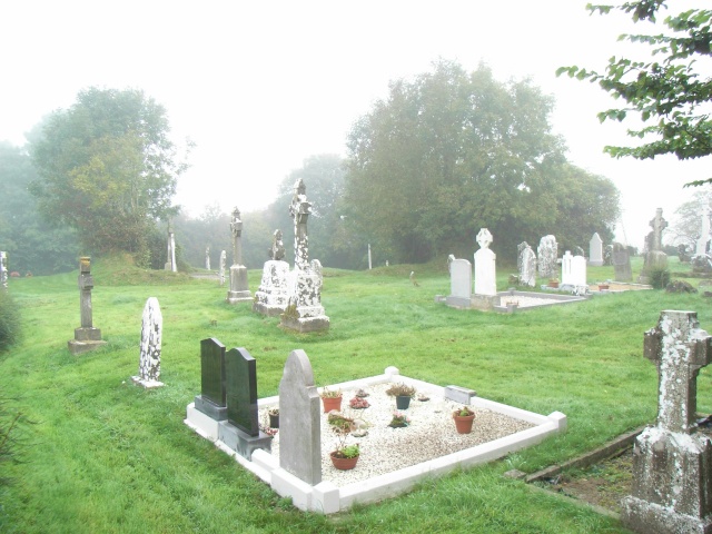
Located on a rise in a level landscape. Ussher (1622) describes the parish church of Churchtown as in ruins (Erlington 1847-64, 1, lxxxv), and Dopping (1682-5) says it was ‘ruined time out of mind’ and was not enclosed (Ellison 1972, 12). The grass-covered remains of the N and S walls are visible with parts of the overgrown E and W walls. The base of a cross-wall (Wth 0.75m) divides it into W (int. dims 10.65m WNW-ESE; 4.95m NNE-SSW) and E (int. dims 8.7m WNW-ESE) sections, but it is not certain if this is original. Parts of the overgrown N and S walls survive (H 1.8-2m) towards the E end but there are no visible architectural features. A piece of a dressed window-surround with a glazing-groove is in the rectangular graveyard (dims c. 60m N-S; c. 35m E-W) defined by masonry walls that are obscured by vegetation. The headstones date from c. 1800 to c. 1980.
The above description is derived from the published 'Archaeological Inventory of County Meath' (Dublin: Stationery Office, 1987). In certain instances the entries have been revised and updated in the light of recent research.
Compiled by: Michael Moore
Date of revision: 2 January 2015
The monument record does not grant public access. Check the route and ask the landowner before entering private land.