Add your own picture and explain the route, parking, gates, paths or landmarks that help people find it.
Earn 5 points after the picture is checked and accepted.
Add your photo and local directionsShare what you foundWhat is recorded here
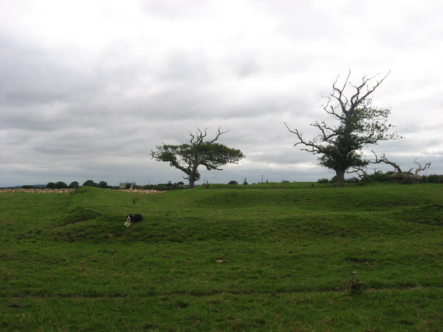
Situated on rise in a low-lying, level landscape. This was a chapel-of-ease to Moorechurch parish church (ME028-010----), c. 3km to the WNW. The church of Mora and its chapel are listed together in the ecclesiastical taxation (1302-06) of Pope Nicholas IV (Cal. doc. Ire. 5, 252), but this need not be that chapel. It is not mentioned by Ussher (1622) (Erlington 1847-62, 1, lxiv) but it is described in Dopping’s Visitation (1682-5) as St. Peter’s of Moymordry. The church was out of repair at that time and the churchyard was not enclosed (Ellison 1971, 34). The name Moymordry is derived from Magh Muireadha – Muircheadach’s plain – referring to the coastal plain in Meath, and was an older name for name for the area that is now Mosney townland (Ward 1965, 251).
The church is a grass-covered sunken area (dims 17m E-W; 8.8m N-S) defined by remnants of walls (Wth c. 1.2m; int. H c. 0.5-0.8m) at the S edge of a raised triangular plateau (dims c. 46m N-S; c. 40m E-W) defined by scarps (H up to 1.2m) with the apex at N. This plateau is separated by a berm (Wth 2-10m) from a grass-covered earthen bank (at W: Wth 2.2m; int. H 0.5m; ext. H 1.1m; at E: Wth c. 7m; int. H 1.4m) at W, NW and E, which may be modern. There is no evidence of burial, but according to Cogan (1862-70, 2, 255) the graveyard was removed along with remnants of the church c. 1854. Two decorated stones from the site were incorporated into Mosney House when the camp was developed in 1949 (Ward 1965, 255). One (ME028-012002-) is an armorial stone representing Barnwall and another family represented by a toothed cross, and the other (ME028-012003-) is a spandrel decorated with what might be a goat’s head in relief.
The above description is derived from the published 'Archaeological Inventory of County Meath' (Dublin: Stationery Office, 1987). In certain instances the entries have been revised and updated in the light of recent research.
Compiled by: Michael Moore
Date of revision: 23 December, 2014
The monument record does not grant public access. Check the route and ask the landowner before entering private land.