Add your own picture and explain the route, parking, gates, paths or landmarks that help people find it.
Earn 5 points after the picture is checked and accepted.
Add your photo and local directionsShare what you foundWhat is recorded here
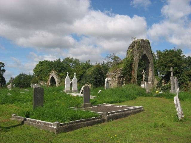
The parish church of Moorchurch is situated within a rectangular graveyard (dims c. 110m E-W; c. 60-70m N-S) defined by earthen banks and hedges on every side except the E where a masonry wall borders a NNE-SSW public road. It is located on a level landscape. According to the Dopping (1682-5) and Royal (1693) Visitations the church of the Blessed Virgin Mary at Mora had been unrepaired since 1641 and was not enclosed (Ellison 1971, 34).
This is a divided nave (int. dims 15.2m E-W; c. 8m N-S) and chancel (int. dims 7.7m E-W; 6.05m N-S) church (total L c. 26m), but the W wall and the N wall of the nave do not survive and the other walls are reduced and overgrown. There is a W porch (int. Wth 1.4m; L 3.3m) and an E porch (Wth 1.8m; L 2.12m) on the S wall of the nave with the area between them added to the nave as an aisle. The pointed chancel arch (Wth 5.03m) survives complete and has a plaque (dims 0.69m x 0. 31m) commemorating Dame Janet Sarsfield, dowager of Dunsany, who died in 1597 and is buried in the church inserted into the N pier (Mems Dead 1904, 124). A sacristy (int. dims 3.95m N-S; 3.05m E-W) of two stories was added to the N side of the chancel, which necessitated the closing of the E window on the N chancel wall. The sacristy is entered by a pointed doorway (Wth 0.7m; H 1.35m) from the chancel, but no other features of the chancel survive apart from corbels in the E and W walls for the first floor and a small rectangular window in the N wall at the first floor.
The above description is derived from the published 'Archaeological Inventory of County Meath' (Dublin: Stationery Office, 1987). In certain instances the entries have been revised and updated in the light of recent research.
Compiled by: Michael Moore
Date of upload/revision: 18 August 2014
The monument record does not grant public access. Check the route and ask the landowner before entering private land.