Add your own picture and explain the route, parking, gates, paths or landmarks that help people find it.
Earn 5 points after the picture is checked and accepted.
Add your photo and local directionsShare what you foundWhat is recorded here
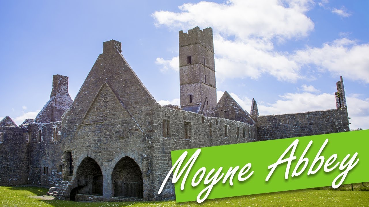
This ecclesiastical enclosure consists of a subcircular area (135m E−W; 125m N−S) defined by a stone wall (Wth 2-3m) Much of the wall has been rebuilt in the relatively recent past, more or less on the line of the original wall. Sections of the original wall constructed of large limestone blocks can be seen at W and N, where the internal wall face survives to a height of H 1.6-2m, and the lowest courses of the original external wall face remain in situ. The current entrance at W is modern. The location of the original entrance is uncertain; it may have been at S where there is a break in the wall, now blocked up (Manning 1987, 41). Roughly in the centre of the grass-covered interior of the enclosure, there is a church (MA123-060002-). A graveyard (MA123-060003-), covering an area of c. 50m N−S by 50m E−W, lies to W and S of the church. A modern access road leads from the current entrance at W towards the church and graveyard. A pair of standing stones (MA123-060006-) are located to W of the church on the NW limits of the graveyard. A complex series of low grass-covered banks and indistinct undulations subdivide the interior. These were well recorded in the 1970’s in a series of aerial photographs (SMR file: CUCAP BDN 85-87). On the ground, the most clearly defined subdivisions include two subrectangular areas (40-50m NE−SW; 20-30m NW−SE) abutting the enclosure wall at NW−N. Though internal divisions are sometimes a feature of early medieval ecclesiastical enclosures, an archaeological excavation in 1982 has shown that some at least of the internal subdivisions at Moyne are late in date, perhaps medieval or post-medieval (Manning 1987, 52 & 59). This excavation, though limited in area, uncovered evidence of pits and ditches which were early medieval in date, contemporary with the early occupation of the ecclesiastical enclosure. Finds included animal bones, iron slag, iron knives, and worked bone and antler. Also contemporary with this period was a lintelled grave, a sample of bone from which produced a radiocarbon date of 1090 +/- 85 R.B.P. (ibid., 50). Other features uncovered, such as hearths, pits and burials, could not be closely dated, but belonged to later medieval and post-medieval phases of activity on the site.
Little is recorded about Moyne. In pre-Norman times it lay in the territory of Conmaicne Cuile Tolad, which was roughly equivalent to the modern barony of Kilmaine. Moyne may have been one of the churches which Tírechán, writing in the late 7th century, claimed was founded by St. Patrick in this territory. The area came under Anglo-Norman control in the middle of the 13th century, and was controlled by the Burkes in later medieval and post-medieval times. The church is given a value of one pound in the ecclesiastical taxation of 1302-6 (Sweetman 1886, 229). This indicates that at that time it was in use and the centre of a parish; the church may have gone out of use by the early 17th century (Manning 1987, 38-41).
Compiled by: Jane O’ Shaughnessy
Date of upload: 3 August 2017
The monument record does not grant public access. Check the route and ask the landowner before entering private land.