Add your own picture and explain the route, parking, gates, paths or landmarks that help people find it.
Earn 5 points after the picture is checked and accepted.
Add your photo and local directionsShare what you foundWhat is recorded here
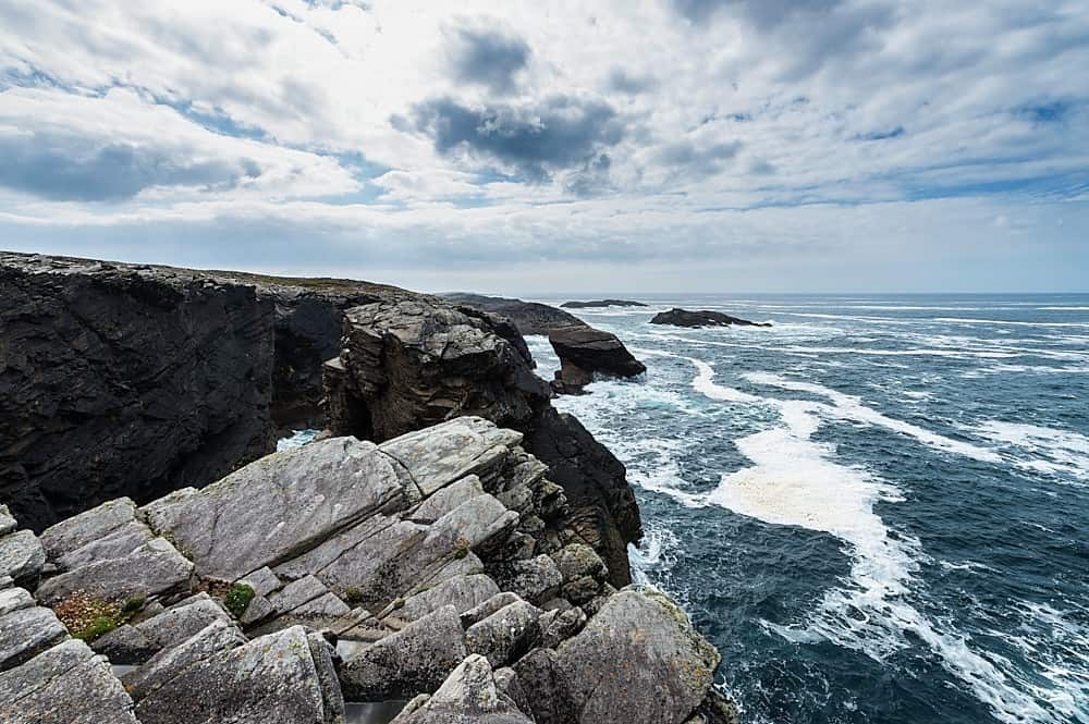
This monument, known as 'Doonamo', stands at the end of a long peninsula in an upland area of rough grazing and bog. It is the highest point for a radius of about a mile and the view from the site is excellent in all directions. The site consists of an irregularly shaped area about 140m long by 85m wide which was defended by a series of walls and ditches running across the narrowest point of the headland. The main defensive feature is a large stone wall about 40m in length. It was built of large drystone random coursed masonry with a rubble core and reaches to a maximum height of 1.8m near its northern end. The outer face remains six courses high in places and although the revetting is visible only intermittently, its original width can be determined at 3.7m. The wall is now 8m wide including collapse. A 1.1m wide gap which lies near the centre of the wall is part of a complex entrance feature. A steep sided round bottomed stone revetted ditch measuring 7m in width lies immediately outside the wall. Its base lies 2.9m below the wall and 1.95m below the outer edge. The base of the ditch is filled with rubble from the wall and it becomes grassed over and less clear towards the northern edge. A small hut was built into it near the entrance causeway which crosses it about 20m from the northern edge.
A second wall ran across the neck of the promontory immediately outside the ditch. This is now 5m in width and stands 1.2m high. It is clearly visible only for a 15m length N of the entrance, otherwise it has collapsed. No trace of any revetment remains but an exposed section through the wall show that it was built of stone. This stone wall curves around the entrance causeway to meet the main wall. Outside this wall are the poor remains of a shallow ditch with a counterscarp bank lying outside it. It is 1.4m wide at its base and is 3m-5m wide at the top. It lies 1.2m below the wall and barely 20cms below the outer field level. This ditch and bank only exist north of the entrance and lie convex to the land.
The other defences are straight. The entrance causeway is flanked by a faint 1m wide low grassed-over bank or wall on either side. Large recumbent flagstones lie on either side of the gap in the main wall. A circular depression to the N of the causeway is 4.5m in diameter and may be the remains of a circular hut which guarded the entrance. Two smaller depressions each 4m in diameter lying inside the inner face of the main bank south of the gap are the poor remains of two conjoined huts, while immediately to the N of the entrance are the insubstantial remains of an oval hut, measuring 1 5m by 3m. These ill defined remains are all that can be seen of a once very complex entrance.
The interior of the fort slopes up to its highest point near the western edge. Rock outcrop is visible everywhere and loose rocks thrown up by the sea lie along the western and the southern edges. The sod covering is very thin and has been removed by erosion in places. At the western edge of the garth 75m from the defences lie the defaced remains of a cashel (MA009-001010-) of which only the eastern and northern quadrants remain. The wall is 0.8m high and 4m thick. It is grassed over and no revetting or any other features are visible. It can be estimated as being originally about 36m in diameter. Near the entrance are two lengths of low walling. They are 10.5m long and 8m long, and a stone facing is clearly visible. They may be the remains of a rectangular house site (MA009-001011-) or a similar enclosure. Besides this the garth is quite featureless. This site has clearly deteriorated considerably since it was described by the 19th century writers. There is little trace of two mural chambers that flanked the entrance and the 'shield'- shaped entrance feature has entirely vanished. These were described by Westropp thus: '...[the gateway] had evidently later guard rooms, one to the south 17 feet 6 inches long, and two smaller ones to the north nearly buried in debris and not mortar built.' (1912a, 201). The main wall is neither 10'high as described by Brown (1893-6, 641) nor 9' high as Westropp noted. Results of the recent excavation, however, suggest that the defenses were purposely removed earlier in this century by the local FCA faction, who on occasion used monuments like these as firing ranges and adapted the earthworks according to their requirements.
The remains of a children's burial ground (thought by some to be the remains of a stone chevaux-de frise) (MA009-001002-) lie outside the defences while traces of three or possibly four hut-sites (MA009-001004-; MA009-001005-; MA009-001007-; MA009-001009-) can be seen inside. At the highest point of the interior are the poorly preserved remains of a destroyed cashel (MA009-001010-). Outside the site lie the remains of the so-called chevaux -de-frise. It consists of 43 uprights of limestone set into the soft ground. They are spaced about 1.5m apart and average 0.25m high, 0.32m wide and 0.12m thick. Many more can be seen trodden into the ground. All of them lie to the N of the entrance gap and they do not seem to have been set in any regular pattern. Although treated as the remains of a chevaux-de-frise by previous writers (Pococke 1752; Trotter 1817; 0 Donovan 1838; Otway, 1815; Brown, 1894; Woodmartin, 1894; Westropp, 1912a, 201; 1912b, 11 & 15; 1922a, 124; Harbison, 1971), this feature resembles the remains of a children's burial ground more than they do the chevaux-de-frise of Dun Aenghus, Dubh Cathair or of Ballykinvarga. The results of an excavation of this feature and part of the defensive elements by the writer in 1992 support this hypothesis (Casey, 1999).
These descriptions are derived from the MA thesis of Markus Casey 1999 The coastal promontory forts of Ireland. A survey of counties Sligo, Mayo, Galway and Clare. Unpublished MA thesis, National University of Ireland, Galway. In this instance the entry has been revised and updated in the light of recent research.
Date of upload: 5 December 2018
This monument is subject to a preservation order made under the National Monuments Acts 1930 to 2014 (PO no. 188/1950).
This remains an important historical record, but the official description says the monument is no longer visible or has been destroyed.
The monument record does not grant public access. Check the route and ask the landowner before entering private land.