Add your own picture and explain the route, parking, gates, paths or landmarks that help people find it.
Earn 5 points after the picture is checked and accepted.
Add your photo and local directionsShare what you foundWhat is recorded here
Medieval church in the village of Knockainy, depicted as a ruinous structure on the 1654-7 Down Survey map of Knockainy parish (NLI MS 718). The church of Anye [Knockainy] is mentioned in the year 1227 when, 'The Prior of Lanthony [Wales] the 1st attorned Brother Richard, his canon, and Philip Walensis, in a plaint before the justiciary of Ireland, between William FitzRobert and Juliana his wife, and the Prior, touching the advowson the church of Anye' (Cal. doc. Ire., entry No. 1555). In 1355/6 the patent Rolls recorded the 'commission to Eustace Haket and Richard Chaumbirleyn, vicar of Any, of custody of the temporalities of the bishopric of Lismore' (Patent Roll 29 Edward III; RCH55/12). In 1374 a letter to the sheriff of Limerick stated that 'William, bp [Bishop] Emly, informed the K. by his letters that William Lyn, formerly vicar of Any in his diocese, and David Browery for a quarter year and more were condemned for heretical pravity by the said bishop, because of which their goods and chattels—which were extended at £28 0s 11d by an inquisition taken before the said bishop' (Close Roll 48 Edward III, RCH 88/95). In 1557 a pardon was granted to 'Cornelius O'Cailte of Any' who is listed as a priest (Nicholls 1994, 311). The 'Towne Green' is annotated on the Down Survey map which shows it located in the field immediately to the W of the church ruins (LI032-141004-) and 'Black Castle' (LI032-141014-) also known as 'Desmond Castle' (NLI, MS 718).
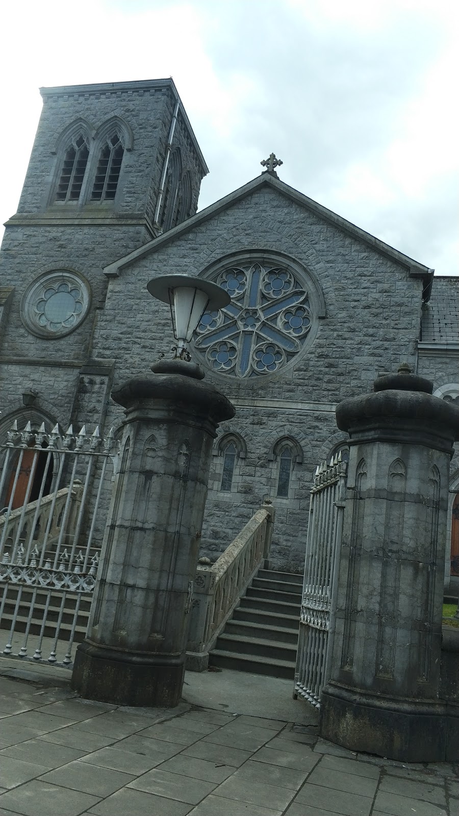
Only the W tower of the medieval church of Knockainy remains upstanding, his tower appears to have been refaced and modified in the 19th century when a steeple was added to the top of the existing tower. At this time a new church was constructed immediately to the N of the bell-tower. This church was deconsecrated in 1999 and was restored by Knockainey Historical and Conservation Society in 2007.
According to the Ordnance Survey letters the parish church of Knockainy was said to 'have been built in the year 1400' (OSL, Knockainey Parish). The Urban Survey of Limerick (Bradley et. al. 1989, 181-2) recorded the following about the parish church of Knockainy; 'The suggestion that this occupies the site of an Augustinian house (Westropp 1904-5, 448) seems to stem from confusion between Knockainy and the Hospital of Any (LI032-147002-), or Hospital as it is known today (Gwynn and Hadcock 1970, 303). There is an old tower on the site which is probably not earlier than the 18th century'.
Westropp (1904-5, 448) recorded the following details about Knockainy Church; Fabric - It is said to date from 1400. The chancel undertaken by Sir Tho. Browne, 1615. The nave was then roofed. It was in good repair, 1840. The R. C. church was built 1836'.
19th century St. John's Church of Ireland Church stands in W quadrant of Knockainy graveyard (LI032-141005-) with bell-tower of earlier church immediately to SE in centre of graveyard. A stone plaque incorporated into the W gable of the church recorded that the present church was built in 1861. In 1942 the following was recorded about a crucifixion slab (LI032-141007-) on the wall of the bell-tower which was described as following; 'On the front of the steeple was a slab, bearing a rude representation of the crucifixion. Slab is presently housed in lower portion of steeple' (ITA Survey 1942).
St. John's Church described by the National Inventory of Architectural Heritage [NIAH] as a 'Freestanding Gothic Revival style Church of Ireland church, built in 1860, with tower and steeple of earlier church adjacent, built before 1762. Freestanding three-stage square-plan crenellated tower to south-east having limestone octagonal spire, dating to eighteenth century' (www.buildingsofireland.ie/ Reg. No. 21903233).
Compiled by: Caimin O'Brien
Date of upload: 26 April 2019
The monument record does not grant public access. Check the route and ask the landowner before entering private land.