Add your own picture and explain the route, parking, gates, paths or landmarks that help people find it.
Earn 5 points after the picture is checked and accepted.
Add your photo and local directionsShare what you foundWhat is recorded here
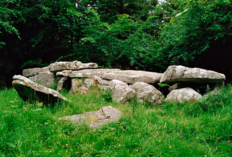
In pasture, which is cut by land drains and watercourses, 130m E of a townland boundary with Rockbarton. A ringfort (LI032-118----) lies 110m to SE. Annotated ‘Giant’s Grave’ on the 1897 ed. OSi 25-inch map where it is depicted as a rectangular-shaped structure (5m E-W; 3m N-S). Described in the Megalithic Survey of Ireland (De Valera & O Nualláin 1982, 78) as: ‘A slab measuring 3.00m by 1.20m, resting above two smaller slabs, 1.00m and 1.50m respectively, in maximum dimension. A stone 1.00m in maximum dimension lies 1.50m to the north of the western end of the upper slab. The object could be the remains of a megalithic tomb but the evidence is not sufficient to warrant its inclusion in our main list’. Upstanding monument is visible as a large flagstone on OSi orthoimages taken 2005-2012, on Digital Globe orthoimages taken 2011-2013 and on Google Earth orthoimage taken 28/06/2018.
Compiled by: Alison McQueen and Vera Rahilly
Date of upload: 8 November 2020
The monument record does not grant public access. Check the route and ask the landowner before entering private land.