Add your own picture and explain the route, parking, gates, paths or landmarks that help people find it.
Earn 5 points after the picture is checked and accepted.
Add your photo and local directionsShare what you foundWhat is recorded here
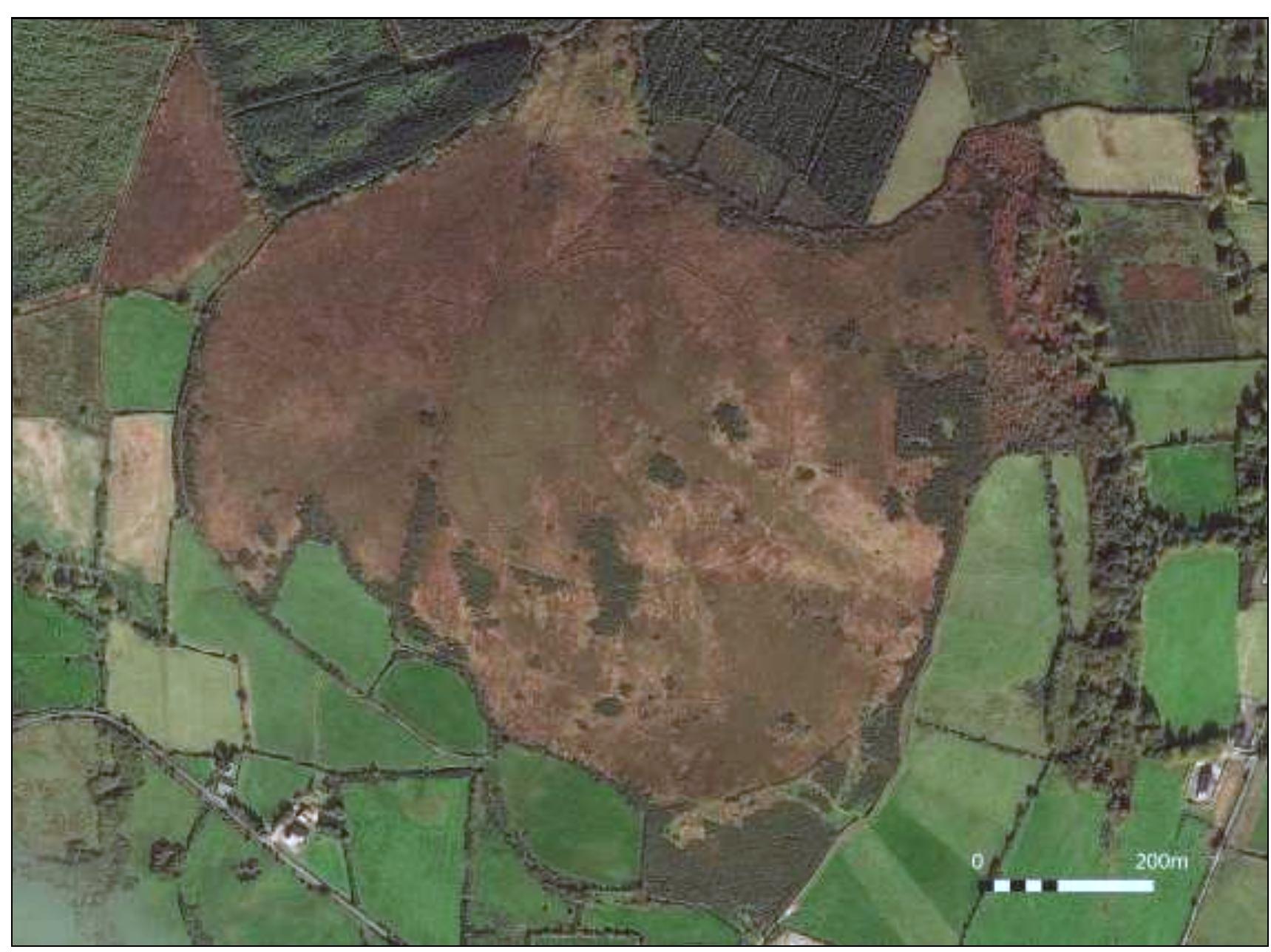
On the summit of Ballylin Hill, the site commands an extensive prospect NE->S over the Limerick plain. The flattish summit of the hill and its upper slopes are covered by heather-clad blanket bog, whilst the steeper lower slopes are covered by heather and gorse. Two roughly concentric rings of embankment enclose the upper part of the hill (Cody 1981, fig. 14). The inner ring encloses a roughly circular area (300m N-S; 315m E-W), whilst the outer ring runs from 80m to 120m outside it. The total area enclosed is 20.5ha (ibid., 71). The inner ring consists of an internal fosse (Wth c. 2.5m; D c. 0.75m) with an external bank (Wth c. 2.5m; H c. 0.75m), both covered by c. 0.3m of bog (ibid., fig. 15). At W is a short stretch of internal bank (Wth c. 2m; H c. 0.3m). There is a causeway entrance (Wth 8m) at ESE. The outer ring has a similar profile 'though of slighter dimensions' (ibid., 71). The outer ring is not evident on the ground for c. 120m W->N, and at N a part of the enclosing element was recently disturbed by deep ploughing. According to Cody (ibid., 75) this site 'falls into Rafterty's Class IIa group of multivallate hill-forts' and is 'undoubtedly one of the largest Irish hill-forts'.
The hillfort was recently described in the Atlas of Hillforts of Britain and Ireland as following; 'Widely spaced multiple enclosure in commanding position on Ballylin Hill. The hilltop is positioned on partial spur in a N - S running escarpment. This provides Ballylin with panoramic views of the Limerick plains and Shannon estuary to the N, E and S. The hillfort has a total site footprint of approximately 20.5ha. Bivallate for its entire circuit with a slight in-turned entrance to the SE. There are two other breaks in the inner enclosing elements which may be original. There are no obvious corresponding breaks in the outer enclosing features. There is no evidence for any internal features on the surface. Geophysical survey has identified a cluster of possible pit features within the inner enclosing elements at the E. The enclosing elements survive well throughout much of its length, however, they are heavily overgrown in places and are under approximately 0.3m of peat. The entire hillfort is under a heavy blanket of heather and patches of scrub. First recorded by John Danaher during aerial photography survey in 1981. Geophysical survey by O'Driscoll (2012). Targeted excavation by O'Brien (2012). Earthwork survey by Cody (1981). Late Bronze Age dates from basal fill of inner and outer enclosing elements. There are three possible original entrances in the inner enclosure. The possible entrances to the SE and W comprise simple breaks in the bank with a causeway in the outer ditch. The excavated entrance at the NE was very slightly in-turned. In comprises a break in the bank and rock-cut ditch. Set just inside the ditch terminals are two large post-holes. The northernmost example was substantially bigger and produced a large number of packing stones. This may suggest that this post held a gate. Circular area defined by two widely spaced, roughly concentric enclosing features separated 80 - 120m apart. Cody (1981) suggests that the inner example consists of an internal ditch (2.5m wide and 0.75m deep) and external bank (2.5m wide and 0.75m high). Excavation and LiDAR survey has revealed that the inner enclosing elements comprised an internal bank and external ditch with an external counterscarp. The outer enclosing elements also comprised an inner bank and external ditch and counterscarp.' (http://hillforts.arch.ox.ac.uk/records/IR0680.html)
See attached Google Earth aerial photograph taken 20/10/2010
Compiled by: Denis Power
Revised by: Caimin O'Brien
Date of revised upload: 30 January 2020
The monument record does not grant public access. Check the route and ask the landowner before entering private land.