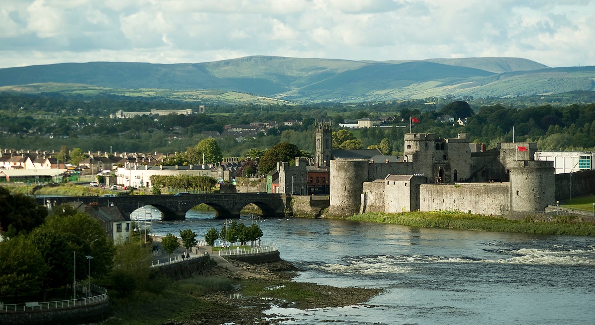
Add your own picture and explain the route, parking, gates, paths or landmarks that help people find it.
Earn 5 points after the picture is checked and accepted.
Add your photo and local directionsShare what you foundWhat is recorded here
Excavations carried out at Charlotte's Quay by Christine Tarbett and Kenneth Wiggins in 1989 were summarised as following; 'The site was located on Charlotte’s Quay along the south side of the Abbey River, a short distance west of Broad Street. It lay on the eastern end of a large car park. The last remaining houses on the north-west side of Broad Street were demolished to make way for a new development. An excavation to the west undertaken by the OPW in 1981 by Dr Ann Lynch exposed the foundations of the medieval town wall (LI005-017010-) and the remains of a twin-towered gate known as the West Watergate. A second excavation was now carried out because trial trenches revealed the existence of stratified medieval deposits to the east of the former excavation limit, and also in order to locate the site of the ‘Castle’ (LI005-017138-) indicated on the O.S. maps of 1840 and 1871. The project was funded by Limerick Corporation and lasted seven months. A single trench was established, for the purposes of excavation subdivided into three: Area 1 (north), Area 2 (centre), Area 3 (south).
Area 2
The dimensions of this area were 7.5m (north-south) by 12m (east-west). It contained stratified deposits up to 1.83m in depth. The earliest feature was a subsoil-cutting ditch aligned east-west. It was partially covered to the north by a compact layer of mortar, deposited directly on the subsoil. This material was probably in phase with the construction of the walls forming the west and south sides of Area 1 to the north. To the east of the mortar was a very large pit, at the base of which was some organic clay which produced an intact leather shoe. In general, though, the material deposited over the mortar surface and into the upper levels of the pit consisted of rather sterile clays and gravels. Two later pits, located on the eastern limit of the area, were filled with dark organic clay containing pottery sherds of 13th- 14th-century date. The pit fills were sealed by dumps of ash material containing small metal artefacts and slag. Quite a large part of the area to the south was covered with hard redeposited boulder clay. Two parallel medieval walls aligned east-west formed the north and south limits of Area 2. They pre-dated the remains of a structure located on the western side of the area. This survived as the east, north and west foundations of a square-planned building, measuring 6.73m (north-south), by 6.3m (east-west). The west wall was the best preserved. It had an external base batter, and faced stonework founded on subsoil survived to a height of 1.09m. The wall had a minimum width of 1.3m. A garderobe chute was incorporated into the north-west corner of the structure with two external outlets. These foundations have been interpreted as the remains of a tower which, based on its dimensions and locality, can be identified as the ‘Castle’ (LI005-017138-) of the O.S. maps.
Conclusion
Given that the excavation was on a large scale, and taking the findings made by the OPW in 1981, it is no surprise that a great wealth of detail has emerged relating to the layout and development of a significant portion of the north-west corner of Irishtown in the medieval period. It is perhaps to be regretted that no domestic dwellings of the period were uncovered; however, the chief objective of the work was to locate the ‘Castle’ (LI005-017138-) of the first O.S. series, indicated well to the west of Broad Street where the majority of the houses would have been assembled. Since the site of the ‘Castle’ (LI005-017138-) was indeed discovered, the excavation can be considered a success. Furthermore, the archaeological record was enhanced by the discovery of a considerable stretch of the original West Watergate Lane, together with evidence for a related tower structure as depicted on William Eyer’s map of 1752.
The most important factor conditioning the settlement of this region of Irishtown was the proximity of the Abbey River on the north side. There was a dramatic drop in the level of natural clay towards the river, which would have been considerably wider than it is today. However, attempts were made in the medieval period to build as close to the river as possible, directly on the low-lying ground. These efforts were represented by the two early east-west walls in Area 1, and the more substantial north-south wall built over them. The former were probably short-lived owing to the rapid silting process inevitable at that level, while the latter seems to have been quickly superseded by the larger wall paralleled with it on the west side. This wall appears to mark the western limit of medieval land reclamation along the south side of the Abbey River. Materials deposited to the east of it were probably introduced specifically to raise the ground level for occupation purposes, though over a fairly lengthy period of time.
The construction surface associated with the large western wall, the mortar-covered ground in Area 2, was itself soon buried beneath gravel and stony clays brought in to establish a new, and considerably raised, ground level. Early pits excavated in Area 2 did not seem to respect property divisions, but these were later formalised with the construction of the two east-west walls. These would have represented the north and south limits of a property fronted by a dwelling located on the corner of Broad Street and West Watergate Lane.
Although the excavation did not extend to Broad Street frontages, our knowledge of Irishtown as a centre for Limerick’s artisan community is augmented by the discovery of the kiln (LI005-17139-) in Area 1, possibly used for corn-drying, and with the excavation of several layers containing slag at the east end of Area 2, which point to the presence of a metal-working business along Broad Street. Otherwise there is a great variety of backyard activity represented by the remains of clay floors, stone scatters, and numerous groupings of stake-holes etc.
The excavation revealed that there was much more to the defences of this quarter of the Irishtown than simply the town wall itself, and the twin-towered West Watergate excavated in 1981. The presence of an inner gate tower and walls flanking the lane which connected that structure to the main gate conveys a definite concern with security. This is confirmed by the subsequent appearance of the tower or ‘Castle’ (LI005-017138-) adjoining the inner gate tower from the north. This desire for strong fortifications is probably a reflection of the strategic location of the West Watergate close to Baal’s Bridge, the only link between Irishtown and Englishtown, or King’s Island, to the north. In the wake of the 18th-century reconstruction of the city, West Watergate Lane was resurfaced and continued as a route leading to Broad Street. However, the other monuments outlined above were levelled and their foundations covered over' (www.excavations.ie).
Compiled by: Caimin O'Brien
Date of upload: 19 December 2019
The monument record does not grant public access. Check the route and ask the landowner before entering private land.