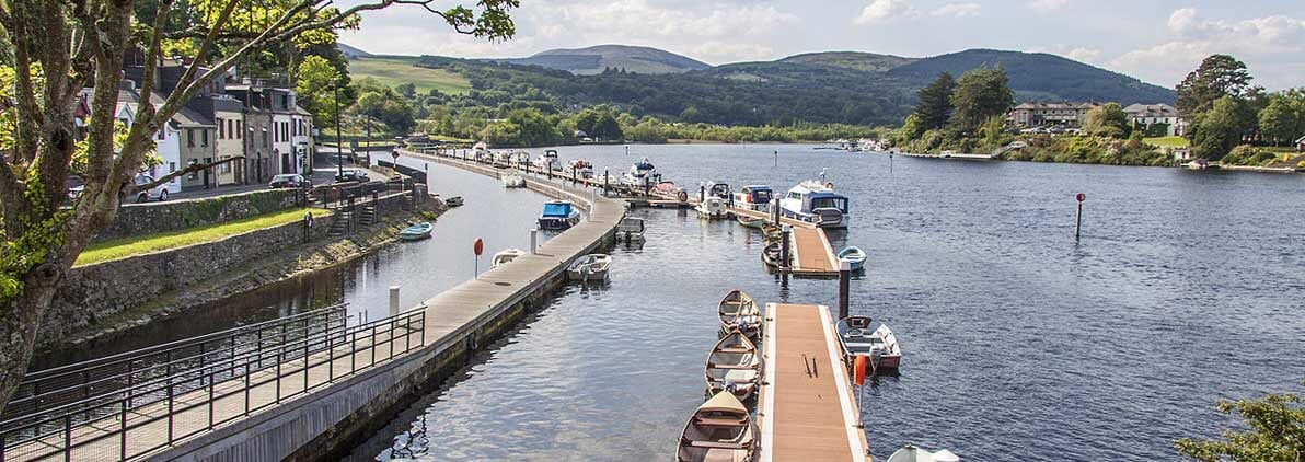
Add your own picture and explain the route, parking, gates, paths or landmarks that help people find it.
Earn 5 points after the picture is checked and accepted.
Add your photo and local directionsShare what you foundWhat is recorded here
Twelve-arch stone bridge (approx. L. 120m] crossing the River Shannon connecting the townland of Montpelier in Co. Limerick with the townland of O'Briensbridge in Co. Clare. The townland of Montpelier was formerly known as 'Portcrushy' (Lower and Upper Portcrusha) as annotated on the 1654-8 Down Survey map of Stradbally parish (NLI, MS 718) and 'Lower Portcrushy' as annotated on the Down Survey map of Clanwilliam Barony (Hib. Reg.). The adjoining townland of Portcrusha lies to the S of Montpelier. The present multi-period stone bridge was first built in the late 17th century and was probably built on the site of a 16th century stone and or timber bridge that was destroyed towards the end of that century. In 1506 the annals recorded that 'The bridge of Port-Croisi [Portcrusha] upon the Shannon was erected by O'Brien, Turlough, the son of Teige, son of Turlough; Donnell, his brother; the Bishop of Killaloe; and the Bishop of Kilfenora' (AFM, 1289). This wooden bridge was destroyed by the English in 1510 when the annalists wrote; 'The Earl (i.e. the Lord Justice) marched with his army through Bealach-na-Fadbaighe and Bealach-na-nGamhna, until he arrived at a wooden bridge (i.e. the bridge of Portcroise), which O'Brien had constructed over the Shannon; and he broke down the bridge, and encamped for the night in the country' (AFM, 1307).
This wooden bridge may have been replaced by a medieval stone and wooden bridge that was defended by two castles, one standing on the Limerick side (LI001-014---) of the bridge and standing 4 arches in from the Limerick shoreline and the second castle (CL054-015----) on the County Clare side. This medieval bridge may have been succeeded by a timber bridge that is depicted in 1681 by Thomas Dineley. A drawing of 'O Briens Bridg-Town' in 1681 by Thomas Dineley shows the bridge and village of O'Brien's bridge as seen from the Limerick side of the River Shannon (NLI, MS 392; Shirley 1858-67, 200). On both Down Survey maps no bridge is depicted but the existence of a bridge is indicated by the annotation 'Brians bridge' / 'Brians Bridg' suggesting the former presence of a medieval bridge crossing the River Shannon at this location (ibid.). The 1654-56 Civil Survey of Limerick described this townland as 'both Porttcuissies' (Simington 1938, 59) which is a reference to Lower and Upper Portcrushy (Portcrusha). There is no mention for the existence of a bridge over the River Shannon at this location in the 1654-56 Civil Survey.
In August 1536 the bridge was attacked and partially destroyed by English forces, under the command of Lord Deputy. A report about this military expedition into Munster, recorded that 'O'Brien's bridge, being fifteen score [300] paces in length, is broken down with bills, swords and daggers, with great labour for lack of pickaxes and crows' (Cal. S.P. Ire., 21). The bridge and its castles were described in 1536 by the English as following; 'On Saterday we came to the said bridge, and after the hoost was encamped, the Deputie with the gunners viewed the same. On this side [Limerick] was a strong castell, buylded all of hewen marbell; and at thother ende [Clare] another castell, but not of such force, booth buylde within the water, somewhat distaunt from the lande. At this eande they had broken 4 arches of the bridge, betwixt the castell and the lande. The gunners bent all the ordenaunce upon the grete castell, on this side, shotynge at it all that day; but the castell was of soch force, that thordenaunce ded in maner no hurte to yt, for the wall was at the lest 12 or 13 fote [4m] thick, and both the castels wer well warded with gunners, galowglas, and horsemen, havyng made suche forifications of tymber, and hoggesheedes of erthe' (Anon. 1834, 351). The destruction of the castles and the bridge by the English was completed the following day when, the Lord Deputy 'caused every of tharmy to make a fagott of a fadome in length to fill that parte of the water betwixt the lande and the castell [LI001-014----], and divised certain ladders to be made; which done, he appoynted a certayne of his awen retynew, and a company of Maister Sayntclows to gyve thassaulte; which we assure you they executed hardely, so as with playne manhode and force the scaled the bridge, which thothers perceyveng, scope oute at thother ende therof, by footemanship; and so they lost booth the bridge, the castels, ther ordenaunce, and all that was els therin; which castels and bridge the Deputie and we have caused to be broken downe to the grounde'(ibid., 352). This bridge may have been constructed mainly from timber with possibly a stone section at either end where the stone castles were standing. The wooden joists of the timber bridge was described in 1536 when the Lord Deputy wrote; 'Ther was slayn of tharmy two gunners, and diverse hurted; and at the losing of the joyntes of the tymber bridge, a grete parte of it ded fall'(ibid.).
The two castles (LI001-014----;CL054-015----) defending the bridge are mentioned in 1538 when 'James of Desmond [was] commanded to cast down the strong castles built on O'Brien's Bridge' (Cal. S.P. Ire.,42)'.
The site of O’Brien’s Bridge and its castles are referred to in a diary kept by a Parliamentarian officer during the campaign of 1650. The entry for 1 June 1650 records that ‘It hath the name of a bridge if any had beene there aunciently which might occasion the name, yet were there not now so much as the ruins of any such thing. Toward the other shore and in the water standeth the stump of an old castle. This we hoped to possesse by ladders to that end prepared, and having gained it to cleere at least in part the contrary shore for a landing place for more men to be sent after. On the land and neere the water were the ruinses of an old house wherein was a guard of the enemies for opposeing our landing. This also being gained might be (as we conceived) some defence for the present, joyned with that of the castle answering it. We had also prepared pallisadoes, and turne-pikes for a suddaine entrenchment untill we could worke ourselves into more security and thereby secure a place for our landing at leasure when thereunto fitted, which was not at present hoped for’ (Gilbert 1879-80, iii, 230).
In 1914 the Limerick Chronicle published correspondence on O'Brien's Bridge which stated that 'it is quite clear that the County Limerick half of it is much newer than the County Clare half. But neither half of it can be very old; as when Captain Draper, of Colonel Sadler's Regiment, forced the passage of the river on the 2nd of June, 1651, there was no bridge there, the first bridge erected by Turlough O'Brien, King of Thomond, in 1506, which was made of wood, had long before disappeared' (Anon 1914, 208). A reply to this correspondence wrote that 'the six arches at the Clare side were built after the Siege of Limerick (1691) by John Brown, of Clonboy, at a cost of £800, and which was done at this own expense. The other half from the Tipperary side was to have been built at the same time by Donal O'Brien, but he did not do so, and there was only a temporary structure until about 100 years after it was built by the County. The old bridge, which was a wooden structure attached to a fort in the middle of the river, was destroyed to prevent the siege guns being brought to Limerick' (ibid., 208-9).
The present stone bridge was described by O'Keeffe and Simington (2016, 287) as following; 'The present bridge is not the one referred to or shown on Rhodes's elevation of 1833. That elevation shows a bridge of fourteen arches and interestingly the eleven arches on the Clare side seem to be Tudor with spans ranging from 5.5 to 7.9 metres. The draughtsman has sketched in a short radius curve at the springing joints in practically all of the arches. The model seems to have been Peter Lewys's 1567 bridge at Athlone [WM029-042004-]. The three remaining arches are three-centred and therefore of later construction; they are located on the Limerick side according to the correspondence quoted above; hence Rhodes's elevation is seen looking upriver'.
O'Brien's Bridge was described recently by the National Inventory of Architectural Heritage (NIAH) as a; 'Twelve-arch limestone road bridge over the River Shannon, built in phases c. 1750 and 1840. Dressed stone walls having cut voussoirs to round-headed arches. V-cutwaters to east and west elevations. Some arches lined with corrugated-iron. This impressive, large multiple-arched bridge forms a prominent landmark in the area, separating County Limerick from County Clare. Built in phases, it replaces an early sixteenth century structure and may still contain fabric from that period' (NIAH Reg. No. 21900107; www.buildingsofireland.ie).
Cross referenced with CL054-004----.
Compiled by: Paul Walsh
Revised by: Caimin O'Brien
Date of revised upload: 30 April 2020
This remains an important historical record, but the official description says the monument is no longer visible or has been destroyed.
The monument record does not grant public access. Check the route and ask the landowner before entering private land.