Add your own picture and explain the route, parking, gates, paths or landmarks that help people find it.
Earn 5 points after the picture is checked and accepted.
Add your photo and local directionsShare what you foundWhat is recorded here
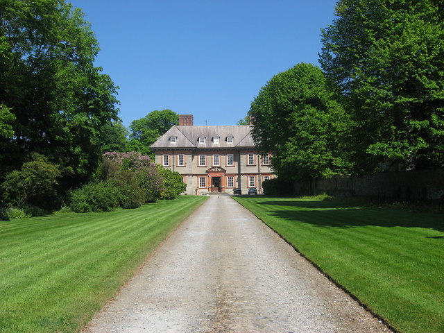
Built near the mouth of the River Boyne by Sir William Tichborne between 1660 and 1667 and said to have been designed by Wren, it is thought to be situated on the site of an earlier manor house belonging to the Plunkett family. It is the only wide-eaved, hip-roofed house of Restoration date now surviving in Ireland (Craig 1982, 146). All of the dressings, including the main architrave, string course and frieze, are of a type of bright red rubbed brick virtually unknown in the rest of Ireland. It is one of the first country houses to be built in Ireland without any fortification.
The house is two storeys high with a dormered attic in the high pitched roof which is carried on a very large wooden cornice. It has a seven bay entrance front with the two bays on either side breaking forward. It has a brick doorcase with a segmental pediment and Corinthian pilasters, while on the side elevation there are two triangular pedimented doorcases with Ionic pilasters (Bence-Jones 1978, 35).
The large two-storey hall contains its original fireplace as well as its doorways, although in the eighteenth century elaborate woodwork was added to it. The dining and drawing rooms have late seventeenth-century moulded panels and ceilings with centred ovals surrounded by heavy garlands of plaster flowers and foliage. The staircase, which has newels in the form of fluted Corinthian columns, dates from c. 1720 (Bence-Jones 1978, 35). (Bence-Jones 1978, 34-5; Craig 1982, 144, 146, fig. 112; Anon. 1908, 299)
The above description is derived from both the published 'Archaeological Inventory of County Louth' (Dublin: Stationery Office, 1986) and the 'Archaeological Survey of County Louth' (Dublin: Stationery Office, 1991). In certain instances the entries have been revised and updated in the light of recent research.
Date of upload: 17 July 2007
The monument record does not grant public access. Check the route and ask the landowner before entering private land.