Add your own picture and explain the route, parking, gates, paths or landmarks that help people find it.
Earn 5 points after the picture is checked and accepted.
Add your photo and local directionsShare what you foundWhat is recorded here
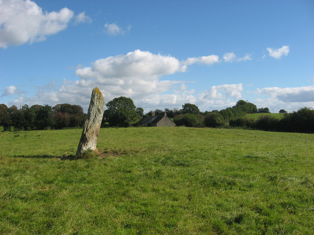
Situated on a slight rise in a gently undulating countryside. The stone (dims of base 1m x 0.4m; H 2.9m) is orientated E-W and leaning slightly to the S. The monument is known as 'Cloch an Fhir Mhóir' – the stone of the big man - and is traditionally associated with the death of Cúchulainn (Gogan 1953). Gosling (2018) points out that there was a possible stone circle (LH011-020001-) c. 40m to the SE and that the stone is c. 70m W of a meandering roadway which is probably older than the mid-eighteenth century that can be traced through maps at least 600m to the N and at least 1.2km to the SW.
This is a National Monument in state guardianship: No. 474
See the attaché view from N
The above description is derived from both the published 'Archaeological Inventory of County Louth' (Dublin: Stationery Office, 1986) and the 'Archaeological Survey of County Louth' (Dublin: Stationery Office, 1991). In certain instances the entries have been revised and updated in the light of recent research.
Date of upload: 17 July 2007
The monument record does not grant public access. Check the route and ask the landowner before entering private land.