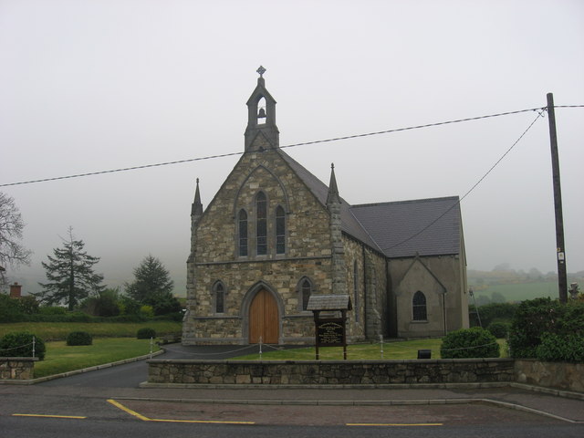
Add your own picture and explain the route, parking, gates, paths or landmarks that help people find it.
Earn 5 points after the picture is checked and accepted.
Add your photo and local directionsShare what you foundWhat is recorded here
Located on a slight rise at the outer edge of a shelf towards the top of the E-facing slope of a broad drumlin. This is the site of the medieval parish church of Oughteragh, which according to John O’Donovan writing in the 1830s was dedicated to St Bridget (Herity 2012, 397). Something is known of its clergy during the fifteenth century when it was united with Drumreilly (LE025-058001-) in the rectory of Cenél Luacháin, which may have been formed from an ancient tuath (Seymour 1935, 250-3). The church could be on an older foundation as the name Oughteragh could be Uachtar Achaid, recorded in the eight century as an estate of the church of Armagh (Mac Cotter 2019, 72). Members of the Maolmochéirghe family (Anglicised: Earley) were hereditary comharba of Cenél Luacháin and the large estate attached to the church of Oughteragh, amounting to thirteen townlands, can be identified as Church or cross land on the Down Survey (1656-8) parish map (ibid. 75). The parish church might have been in use until the Church of Ireland built their present church in Ballinamore, c. 1km to the S, in 1787 (Lewis 1837, 2, 452).
A small circular graveyard (diam. c. 30m) is depicted at the E end of a lane (L c. 70m) from a public road to the W on the 1835 edition of the OS 6-inch map. The church is not marked but a St. Bridget’s Well is in the vicinity, probably outside the graveyard at NE. This well is no longer extant but it is one of two holy wells dedicated to St Bridget attached to this graveyard, the other (LE025-009----) being c. 550m to the NNE at Camagh, reached by the lane running E from the graveyard and a path through the fields northwards. The pattern involving the well in Camagh and the graveyard where there was a stone head known as St Bridget’s Head was held on the first day of February into the 1930s, according to the Schools Manuscript Collection from many local schools, but see this web-page accessed on 26/01/2017: http://www.duchas.ie/en/cbes/4658439/4655797
The stone head is now (LE025-118----) in the outer face of the wall behind the altar of the Roman Catholic church at Ballinamore, which was built in the 1960s, and the only remnant of the medieval church in the graveyard is a small pointed window-head. These are in the old graveyard that still has a masonry wall on its perimeter NW-E-SE, but is now part of a large rectangular graveyard (dims c. 75m NE-SW; c. 75m NW-SE) that has been extended further to the SE and NE. (Gallogly 1991, 4-8)
The above description is derived from 'The Archaeological Inventory of County Leitrim' compiled by Michael J. Moore (Dublin: Stationery Office, 2003). In certain instances the entries have been revised and updated in the light of recent research.
Date of revised upload: 5 July 2017
The monument record does not grant public access. Check the route and ask the landowner before entering private land.