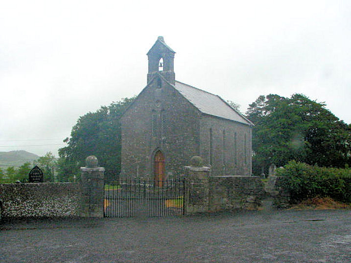
Add your own picture and explain the route, parking, gates, paths or landmarks that help people find it.
Earn 5 points after the picture is checked and accepted.
Add your photo and local directionsShare what you foundWhat is recorded here
In undulating countryside. Reference to a church here (O'Hanlon and O'Leary 1907, vol. 1, 227-8). A nave (L c. 15.5m; Wth 8.1m, wall T c. 0.75m) and chancel (L c. 9.5m; Wth c. 5.3m) church constructed of roughly coursed limestone. The W gable and adjoining portion of N wall are levelled, and only the foundations of the chancel remained at the beginning of this century. Round-headed doorway visible at W end of S wall and blocked up ope at E end which was blocked up in 2000 as part of a millennium clean up scheme. Located off centre to the E in the S wall of the nave there is a partially destroyed window of thirteenth century date. The jambstones of the inner embrasure display evidence of diagonal stone tooling of thirteenth century date. The chancel arch was blocked up when the nave became a burial place in the eighteenth century. During this time the W wall was rebuilt and the interior of the nave was converted into a private burial area. Uninscribed and inscribed grave-markers visible in the surrounding subrectangular graveyard (LA035-031002-). Gateway (LA035-031003-) with rebated entrance (Wth c. 5.1m; D c. 3.3m; wall T c. 1m) lies 11m to SW of church. Large subcircular enclosure (LA035-031004-) surrounding site is visible on aerial photographs (CUCAP, BDL 18, 27-8). Evidence of possible bank at E and S, no other surface remains survive. This enclosure appears to run off the gateway and is part of the enclosing element of the church and graveyard. The gateway appears to be the medieval entrance into the enclosed church and graveyard. This enclosing element now only survives as a low rise of ground which may indicate the line of a stone wall which enclosed Toberboe church and graveyard in the medieval period. The church was in ancient times known as 'Cill Finnce' which may be the Church of St. Finneach, whose feast day is on the 2nd of February (Carrigan vol. 2, 226). Another alternative is that this church was dedicated to St. Finche who is commemorated on Jan Ist or after St. Fainche who was venerated at Clonkeen church, Co. Laois whose holy day is on Jan. 21st (Carrigan vol. 2, 226-7). In the medieval period the church was dedicated to St. Brendan whose patron day was on May 16th (Carrigan vol. 2, 227). In the sixteenth century the church and parish of Killiny belonged to the Augustinian Canons of the Priory of Inistioge, Co. Kilkenny. On the 26th June, 1577, James and Edward Cuffe were granted several rectories belonging to the said Priory, among them. Kylline (Killiny) in "the country of MacGillaptricke" and in Dec. 1591, Piers Hovenden received a grant of the same rectory, under the designation of "Killenny in M'Gilpaterick's country" (Carrigan vol. 2, 227).
Described by Carrigan as 'The parish church of Killiny stands in ruins in the townland of Killinymore otherwise Tubberboe. It consisted of nave and chancel. The nave is 43 ft. long, on the outside, and 27 ft. wide, the walls being 3 ft. thick, and the side-walls 12 ft. high. The west gable and all the adjoining portion of the north side-wall are gone to the very ground. In the south side-wall, near the west end, there is a doorway, round-headed, on the inside, and 7 ft. high, and broken on the outside; there is a flat-headed window of unhewn stone towards the east end of the same wall, measuring 3 ft. 5.5 in. in height on the outside and 6 in. in width, and splaying internally to the width of 6 ft. The east gable of the nave was pierced by two doors, one of which, 6.5 ft. from the north side-wall, was curved at the top, was 6 ft. 9 in. high by 4 ft. 5 in. wide and was built of rough stones; the other, 4 ft. 2 in. south of this, is now destroyed. All this gable, except a small part of the south end, is later by some centuries than the side-walls which judging from the character of the masonry, are certainly not later than the year 1200. Only portions of the foundations of chancel remain; they show it to have been about 32 ft. long by 19 ft. wide; the walls being 2.5 ft. thick. The interior of the nave has been appropriated as a burial place by the Philippses of Rapla, the Lodges of Graigueavoice and the palmers of Dereen'. (Carrigan 1905, vol. 2, 227).
The above description is derived from the published 'Archaeological Inventory of County Laois' (Dublin Stationery Office, 1995) compiled by P. David Sweetman, Olive Alcock and Bernie Moran. In certain instances the entries have been revised and updated in the light of recent research.
Date of upload: 17 December 2007
This remains an important historical record, but the official description says the monument is no longer visible or has been destroyed.
The monument record does not grant public access. Check the route and ask the landowner before entering private land.