Add your own picture and explain the route, parking, gates, paths or landmarks that help people find it.
Earn 5 points after the picture is checked and accepted.
Add your photo and local directionsShare what you foundWhat is recorded here
Not marked on the 1841 or 1909 editions of the OS 6-inch maps. In 1614 it was owned by the Cosbys and John Johnson had acquired the tenancy, two years later it was acquired by Thomas Warde. A deed bearing date of 2nd of December 1616 indicates that Thomas Warde paid Richard Cosby for rent of Kilmartyr (O'Hanlon and O'Leary 1907, vol. 1, 272). The old townland of Kilmartyr has been subsumed by the townland of Ballymaddock (O'Hanlon and O'Leary 1907, vol. 1, 272). According to O'Hanlon and O'Leary the foundations and basement cellar of the old castle are still to be seen in the middle of an open field; but no mark to indicate their site can be traced on the map (O'Hanlon and O'Leary 1907, vol. 1, 272). According to local tradition this was the site of a castle which was destroyed with dynamite in the 1950s/60s. There is a considerable amount of stone lying at the base of the field boundary enclosing the former site on its E side - this is most likely clearance from the collapsed remains of the castle. No visible surface remains.
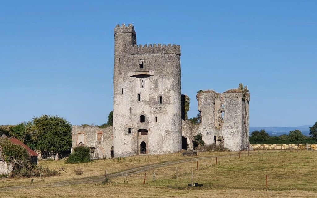
Ruins of a building known locally as 'the Monastery'. (Comerford 1886, vol. 3, 281). No visible surface remains. Comerford described the site as in the townland of Ballymaddock, in this parish, are the ruins of two distinct buildings, quite contiguous to each other; one is locally known as 'the Monastery' and the other is the Castle of Ballymaddock (LA014-026----). There is no evidence to show that a religious house existed here, nor do the ruins themselves afford any proof of their having been designed for that purpose. The probability is that it was an ancient castle or castellated mansion. The other building is designated on the OS 6-inch map, 'the house of cahir-nacapul, in ruins', but is more generally known in the district as Squire Weavers house, a name, no doubt, derived from a former occupant (Comerford 1886, vol. 3, 281).
According to O'Hanlon and O'Leary the 'monastery' consisted of the end wall only remains, with a part of the side wall, which is perforated by a small window. other portions have been removed; and they were probably employed in the erection of the barn, which occupies the space between the 'monastery' and the gable wall of the old mansion (House of Cahernacapol - LA014-026----). The walls of the 'monastery' are of great thickness. The gable end appears to have been breasted on the interior with a massive pile of masonry, which must have served the purposes of a chimney, although at present, it is in so ruinous a condition, that the use for which it had been intended cannot be very accurately conjectured. The great probability is that the 'monastery' as locally denominated by the peasantry, was only a portion of an ancient castle or mansion. A few small perforations for windows, which yet remain, would serve to confirm this impression, as in style they are altogether unlike openings to be found in ecclesiastical remains. Human remains have been turned up frequently from the earth near these buildings (O'Hanlon and O'Leary 1907, vol. 1, 273).
The above description is derived from the published 'Archaeological Inventory of County Laois' (Dublin Stationery Office, 1995) compiled by P. David Sweetman, Olive Alcock and Bernie Moran. In certain instances the entries have been revised and updated in the light of recent research.
Date of upload: 17 December 2007
This remains an important historical record, but the official description says the monument is no longer visible or has been destroyed.
The monument record does not grant public access. Check the route and ask the landowner before entering private land.