Add your own picture and explain the route, parking, gates, paths or landmarks that help people find it.
Earn 5 points after the picture is checked and accepted.
Add your photo and local directionsShare what you foundWhat is recorded here
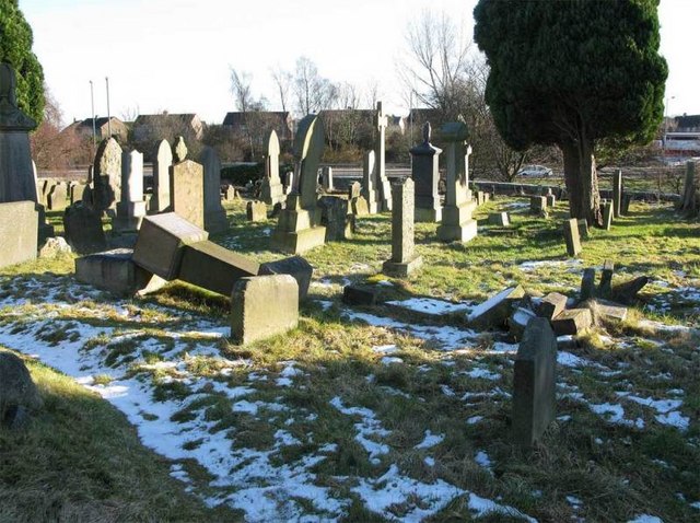
Situated on the demesne land of Portnahinch House which is 80m to the NW as indicated on the 1838 edition of the OS 6-inch map. The church is standing on raised ground 50m SW of Portnahinch Bridge which crosses the River Barrow and was the only fording point over the River Barrow in this region. This section of the River Barrow forms the boundary between Laois and County Offaly. Tinnakill Castle (LA008-001001) belonging to the MacDonnell family is 1.6km to the SE, Clonyhurk Castle (OF033-005003) and church (OF033-005001) in Offaly are 3.1km to the N. No church is indicated in this area on the 1563 map of Laois-Offaly which shows a bridge crossing the River Barrow on the site of the present Portnahinch Bridge. The Down Susrvey (1655-6) map of Portnahinch barony depicts no church building in this townland. Morrett Church is the only church in this area that is listed in the 1302-06 Ecclesiastical Taxation of Ireland. The church was described in the 19th century as 'an old church, in ruins, stands here in an extensive graveyard; portions of the four walls remain, and show it to have been very small and very ancient; it measures about 40 feet [12.2m] in length, by 16 [4.9m] in width; there is a window in the west [east] gable, 31/2 feet [1m] in height and only 4 inches [0.1m] wide; another window, still smaller, appears on the Epistle [S] side of the altar place' (Comerford 1883, vol. 2, 254). Present remains consists of the ruins of a church (ext. dims. 6.7m N-S, 13m E-W, wall T 0.9m), in fair condition, built of roughly coursed rubble limestone. The head or top of the E window is missing its cut stone surround, and has cut stone jambs which display evidence of punch dressing and possible diagonal stone tooling. The E window is a narrow slit ope which is unusually narrow and similar to slit opes found on tower houses rather than churches. Internally this slit ope is set into a segmental arched window embrasure in the centre of the E wall. There are the remains of a similar poorly preserved narrow slit ope at the E end of the S wall very close to the SE angle of the church. There is no evidence of any other window in the S wall of the church. There was no window in the N wall which is completely intact. The church was entered through a doorway, now broken out, in the centre of the poorly preserved W wall. The dating of this church is problematical and it has been suggested that it may date from the fourteenth century based on the stone-dressing of the window surrounds. Alternatively it is possible that this church with its narrow slit opes dates from the seventeenth century plantation of Laois and was built as a church associated with the first house constructed at Portnahinch. The church is located in the NE quadrant of a rectangular shaped graveyard (LA004-004001-) and is approx. 3m to the S of the inner face of the N section of the enclosing graveyard wall and approx. 3m E of the inner face of the E wall of the graveyard. Sheela-na-gig (LA004-006002-) that is now buried near Tinnakill Castle (LA008-001001-) may have come from this church.
The above description is derived from the published 'Archaeological Inventory of County Laois' (Dublin Stationery Office, 1995) compiled by P. David Sweetman, Olive Alcock and Bernie Moran. In certain instances the entries have been revised and updated in the light of recent research.
Compiled by Caimin O'Brien
Date of upload / revision: 23rd May 2011
The monument record does not grant public access. Check the route and ask the landowner before entering private land.