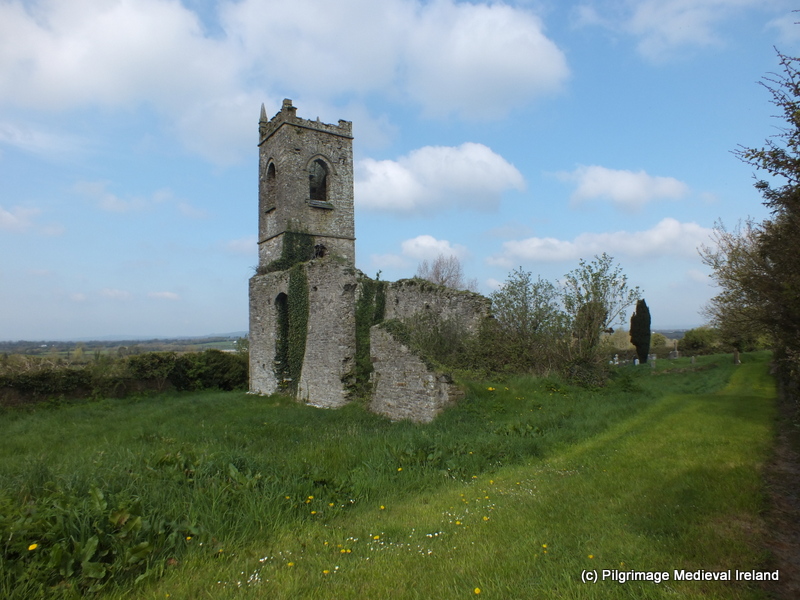
Add your own picture and explain the route, parking, gates, paths or landmarks that help people find it.
Earn 5 points after the picture is checked and accepted.
Add your photo and local directionsShare what you foundWhat is recorded here
On raised ground at the base of a hill which rises to the S-SE, in rolling pasture overlooking a broad plain from NW-N. The land drops away steeply immediately N of the church where there is a small valley with St. Nicholas’s holy well (KK030-008007-) to the NW in this valley. The land rises again immediately N of this forming a hillock on which stands a high cross (KK030-008004-), the whole being encompassed by the graveyard (KK030-008010-). There is a motte (KK030-008001-) c. 125m to the NNE. Located 5m N of the N wall of the ruinous Church of Ireland church. According to Carrigan (1905, vol. 4, 311-2) a monastery here was founded by St. Gobán Fionn early in the 7th century whose festival is celebrated on the 6th of December. It would appear that in the 15th century Killamery was a prebendal parish (the rents, fees and tithes of the parish supported a member of a cathedral, in this case St. Canice’s in Kilkenny) as in the Calendar of Ormond Deeds of 1403 there is a reference to ‘Richard Whitesyde, cleric, prebendary of Kyllamerry’ (Curtis 1934, vol. 2, 268).
Of the church, the lower courses of the E end of S wall (L 8.6m; H 0.5-0.55m; T c. 1m) and S end of the E wall (L 4.55) survive, though only the internal face of the wall is visible. It is composed of roughly cut boulders in the S wall with smaller stones in the E wall. The N portion of the church has been quarried out, including the N wall and N end of the E gable. The W end of the S wall and the W gable are not visible at ground level. In the OS Letters (O’Curry 1840, 97), it is described as, ‘The foundation, between three [0.9m] and four feet [1.2m] high, remains on the southeast side of the churchyard or burying ground, measuring twenty three feet [7m] by eighteen [5.48m], walls two feet nine inches [0.84m] thick; this part would appear to have been the Quire of the church as vestiges of some more extensive building may be traced projecting west from it. There is a yew tree within the area of the Quire (choir) five feet [1.5m] in circumference and two white thorns of good growth near it’. There are a number of 19th century graveslabs lying flat within the interior area of the church. There is a cross-slab (KK030-008011-) in the graveyard c. 10m WNW of the church. At the N portion of the graveyard, near the high cross (2.7m to the SE of the high cross), is a fragment of a sandstone round-headed window head (dims. L 0.42m; T 0.16-0.19m), chamfered internally and externally (D of chamfers 0.05m and 0.07m) with lime mortar (T 0.02-0.025m) on one side of the stone. Also in the same area there is a fragment of a jamb (dims. L 0.43m; Wth 0.25m; H 0.32m) with a roll-moulding (diam. 0.12m).
Compiled by: Jean Farrelly
Date of upload: 26 July 2017
The monument record does not grant public access. Check the route and ask the landowner before entering private land.