Add your own picture and explain the route, parking, gates, paths or landmarks that help people find it.
Earn 5 points after the picture is checked and accepted.
Add your photo and local directionsShare what you foundWhat is recorded here
Templemanaghan/Teampall Mhanacháin or Teampall Geal (KE043-140001-) and its associated burial ground lie on the lower E slopes of Lateevemore and command a magnificent view over Dingle Harbour and the Milltown valley. A souterrain (KE043-140004-), known as Poulnasaggart/Poll na Sagart, at the W extremity of the site, is now inaccessible. The well entrance lies at the E side of a subcircular mound measuring 5.4m N-S x 4.8m E-W x 1.1m in height. The drystone-built chamber to W of the entrance is not accessible but is c. 1.35m high and at least 2m long. Two further chambers were formerly accessible (OPW).
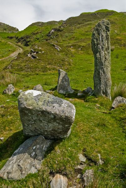
See attached photograph courtesy of Amanda Clarke
The above description is derived from J. Cuppage, ‘Corca Dhuibhne. Dingle Peninsula archaeological survey. Ballyferriter. Oidhreacht Chorca Dhuibhne’ (1986), no. 824. In certain instances the entries have been revised and updated in the light of recent research.
Date of upload: 8 August 2013
The monument record does not grant public access. Check the route and ask the landowner before entering private land.