Add your own picture and explain the route, parking, gates, paths or landmarks that help people find it.
Earn 5 points after the picture is checked and accepted.
Add your photo and local directionsShare what you foundWhat is recorded here
Estimated internal diam. 32m
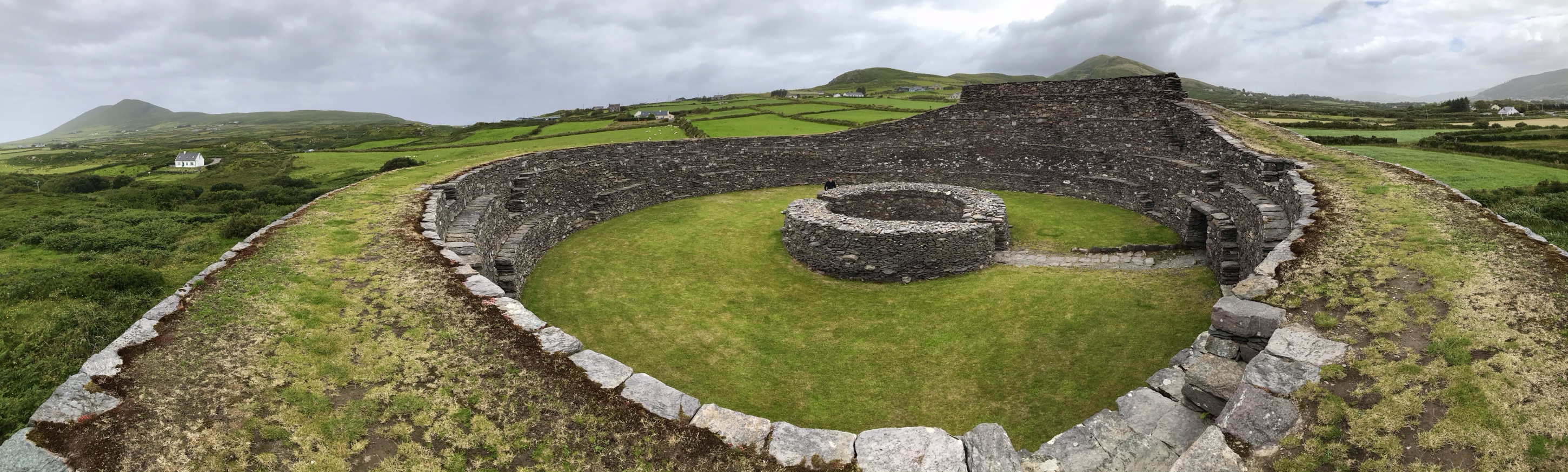
Caherlea/Cathair Léith: Situated on the headland which forms the W side of the entrance to Smerwick Harbour. To N the land rises gently to the ridge known as the Three Sisters, and to S it falls gently to the cliffs which border the harbour. The enclosure was described in the OSNB (Dunurlin, 25) as a circular fort composed chiefly of stone, and Curran (no.4) describes the 8 foot (c. 2.4m) thick enclosing wall as almost completely destroyed. To E and S the site is now defined by straight field walls, but its circular outline is still traceable around the remainder of the perimeter. To W it is defined by merely a difference in height between the level of the raised interior and that of the surrounding field, but to N there are traces of a slight bank.
The E segment of the interior is fairly level, but in its W segment a ridge or mound of turf-covered earth and stones extends N-S for 27m. It is c. 0.4m high and a maximum of 6.5m wide. The function of a number of features located along the top of this is not clear. They include a group of large prostrate slabs, a pit now infilled with loose stones, 2 stones set on edge near this latter, and a circular and an oval depression measuring 2m and 2.3m x 1.4m in diameter. Curran noted 2 structures, presumably hut-sites, in the interior. These were 13 feet (c. 4m) and 9 feet (c. 2.7m) in diameter and therefore appear to be too large to be equated with the depressions.
The present entrance to a drystone-built souterrain occurs c. 4 to 5m inside the edge of the scarp which defines the W portion of the enclosure. From here a passage extends 1.5m to ENE to meet a 2nd passage running at right angles to it. This latter is up to .85m high and from .6m to 1m in width, but its exact length could not be determined. About 4m from the entrance, the NW end of the passage is blocked by collapsed roofing slabs. However, about 6m beyond this there appears to be an end wall. This is provided, at its SW side, with an entrance gap which may lead to a further chamber or passage. At the SE end of the passage, c. 0.9m from the entrance, a single slab forms the end wall. A neatly executed port-hole, cut out of this at ground level, measures .48m in width x .33m in height. The chamber beyond is now flooded and inaccessible. It has a curved SE end wall and a gap at the E end of the N wall may lead to a further passage or chamber. A piece of pottery was apparently found in the souterrain (O'Sullivan 1931, 509).
An unfinished quernstone lies on the surface of the enclosure. Curran noted a 2nd unfinished quernstone, and the landowner knew of 2 others, with complete perforations, which disappeared from the site about 10 years ago.
The above description is derived from J. Cuppage, ‘Corca Dhuibhne. Dingle Peninsula archaeological survey. Ballyferriter. Oidhreacht Chorca Dhuibhne’ (1986), no. 589. In certain instances the entries have been revised and updated in the light of recent research.
Date of upload: 7 August 2013
The monument record does not grant public access. Check the route and ask the landowner before entering private land.