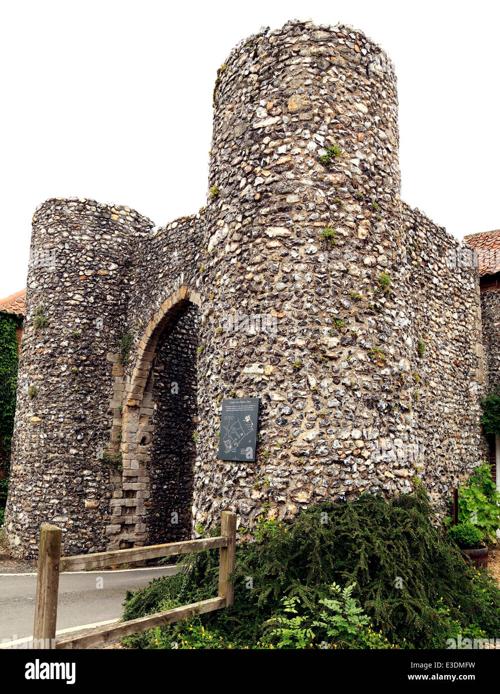
Add your own picture and explain the route, parking, gates, paths or landmarks that help people find it.
Earn 5 points after the picture is checked and accepted.
Add your photo and local directionsShare what you foundWhat is recorded here
The first defensive works in Dublin have been dated to the tenth century (Clarke 2002, 3-4). This comprised an ovoid enclosure made of earth and timber, which occupied the eastern end of a natural ridge overlooking the confluence of the rivers Poddle and Liffey. It straddled the high ground along Castle Street/Christchurch Place and included the river frontage at Fishamble Street/Essex Street West. Within this embankment were a series of long narrow properties defined by post and wattle boundary fences with houses fronting onto streets. These earthen defences were revealed during excavations at Christchurch Place which formed the S side of this settlement and Fishamble Street where it acted as a flood barrier prior to the construction of the city wall. The banks were substantial in size; at Ross Road the final phase measured 4m high by 5m wide, surmounted by a timber palisade fence.
Around c. 1015 AD there was a western expansion of the defensive enclosure to include High St. and Nicholas St. This earthen fortification was subsequently replaced by the first Hiberno-Norse stone wall (Wallace 1981, 109-54). The new wall almost tripled the size of the defended area by including settled land on the west, along High street. It was built of massive limestone blocks, quarried locally. The area enclosed extended from Parliament Street and Exchange Street Upper in the East to Bridge Street on the west and from Cook Street on the north to Ross Road and Ship Street in the south. A significant stretch of this wall survives along Cook Street. A section of this wall was identified during excavations at Ross Road.
The Anglo-Norman's expanded into the pre-existing town c. 1170 and immediately began to re-fortify the town's defences and expand outside the line of the Hiberno-Norse wall. The most ambitious programme , was the construction of Dublin Castle. Funds for building and maintaining walls, mural towers and gates were raised by means of periodic murgage grants. Dublins first charter dates from 1221. Over subsequent centuries the city wall was altered, with crenellations and buttresses added (Thomas 1992, 80). It was extended in the thirteenth-century to enclose the newly-reclaimed areas outside the early city wall with Buttevant Tower placed in the NE side of the reclaimed area at the junction of the old and new wall and Isolde's Tower in the East.
The Anglo-Norman defences in Dublin consisted of a curtain wall with mural towers and gate houses. It has been suggested that there were breaks in it in the east making direct access to the river possible (Simpson 2000, 55). At Dublin castle a rock cut moat was channelled around the castle and fed by the Poddle river. The city walls survive as isolated sections and sections attached to the mural towers. Recent excavations have revealed them below ground surface level. Dublin castle was built in the angle of the existing city walls (Lynch and Manning 2001, 167-204). A barbican gate and drawbridge gave access directly from the town, midway along the N side. The most impressive section of city wall survives at Cook Street, which contains St. Audeon’s Gate Excavations at Woodquay revealed a long section of city wall which is preserved at the Civic Offices. There are upstanding remains of the city wall incorporated into the modern town layout at Lamb Alley and Ship Street Lower (Clarke, Dent and Johnson 2002, 31-2).
Access, in and out of the medieval city, was controlled by gates. These varied greatly in design from those with double-turrets and portcullis, to examples with round and or square turrets or a combination of both. There is little upstanding evidence for these except for St. Audeon's Gate which is heavily restored and the remains revealed at Dublin Castle during 1985-86 excavations. We are largely dependent on historical sources for morphological information, in particular that contained in Perrot's descriptive Survey of the perimeter towers and walls (1585) which indicate that the gates on the S side of the settlement were particularly formidable (Gilbert 1891-1944, ii, 558-561). These appear on Speeds map of 1610 and have been mapped by the Friends of Medieval Dublin (Clarke 1978; Clarke 2002; Clarke, Dent and Johnson 2002, 31-2).
The city wall was defended by mural towers. They are historically well documented but there is little upstanding information. Perrrot's survey (1585) indicates diversity in size and form. Archaeological excavations have revealed sub-surface remains of mural towers such as Geneval's tower at Ross Road and Isolde's tower in Exchange Street.
(315383 233926) (1). Dublin Castle: Known as 'Cork Tower' this was located at the NW corner of Dublin Castle. Under construction in c. 1228; rebuilt in 1413. It stood three storeys above a dungeon in 1585; collapsed in 1624 and was re-built in 1629. It was demolished during the 18th century (Healy 1973, 16). A large portion of the tower was exposed during excavation in 1985-6 (Lynch and Manning1987, 178, FMD map 1978, A1; Lynch and Manning, 2001, 169-204; Clarke 2002, D5).
(315482 233964) (2) Dublin Castle: Known as the 'Store House Tower' or the' Powder Tower' this was formerly located at the NE corner of Dublin Castle. Excavations in 1985-86 uncovered most of the base of the circular tower, sitting on bedrock associated with 14th century layers producing pottery and coins. It overlay a section of rampart that enclosed the Viking town. A section of medieval wall abutted the Powder Tower (Lynch and Manning 1987, 178; Healy 1973, 16, FMD map 1978, A2).
(315500 2333910) (3) Dublin Castle: Stands at the SE corner of Dublin Castle. Variously known as the 'Record Tower', the' Black Tower' and the 'Wardrobe Tower'. Under construction c. 1228; restored and re roofed c. 1566. It is a massive circular tower, three storeys high. Battlements were added in 1819 (FMD map, 1978, A3). Extant in modified form 2002 (Lynch and Manning2001, 169-204, Clarke 2002, 22, D15).
(315460 233880) (4) Dublin Castle: This was a small turret which was located mid-way along the S curtain wall. It was three storeys high in 1585; demolished c. 1766 and a polygonal tower erected on the site (Healy 1973, 17, FMD map, 1978, A4, Clarke 2002, 22, D12).
(315434 233922) (5) Dublin Castle: Tower abutting W side of Bermingham tower, square tower, early 13th (Lynch and Manning 186, 18) little square tower, 3 storeys 1585. Lowest courses extant below ground level 2002, Clarke 2002, 22, D19).
(315338 233832) (6) Ship St. Little: Known as 'Stanihurst's Tower' after James Stanihurst, recorder of Dublin, who owned the adjoining property. The remains still survive on the N side of Ship Street. They are round outside the city wall; square inside the wall and stand three storeys high (H c. 14.5m, T c. 1.8m). It was refaced in the 19th century and has a thick base batter. A section of city wall survives either side of it (Healy 1973, 18, FMD map 1978, A6). This S stretch of town wall (L 85m, H 5m) leads up to the boundary of Dublin Castle. It is built of coursed masonry and battered towards the extra-mural street level, which is on the fosse site (Thomas 1992, 2, 80; Clarke, Dent and Johnson 2002, 32). Extant in modified form 2002 (Clarke 2002, 21, D 18)
(315181 233797) (7) Ross Road: Substantial remains of Geneval's Tower was recorded during excavations in 1992. Remains comprise a rectangular structure attached on either side to the sections of city wall. It probably had an outer element. This replaced an earlier stone wall built in the early 12th century which had itself succeeded a Viking bank of 10th century date (Healy 1973, 18, FMD map 1978, A7; Clarke 2002, 21; D 9 Walsh 1994, 16-17; Walsh 2001, 112).
(315044 233797)(8) No.10 John Dillon Street: Known as the Round Tower or Sarsefield's Tower. The position of this tower is indicated on a deed map of 1780 which locates the site behind No. 10 John Dillon Street. It was a relatively low half round tower (H 4.5m) and was filled with earth. In 1585 it was held by Sir Willaim Sarsefield (Healy 1973, 19; FMD map 1978, A8) (Clarke 2002, 21, D 16).
(314966 233871) (9) Lamb Alley; Known as Sedgraves Tower as Christopher Sedgrave occupied the tower in 1585 (Healy 1973, 19). It was two storeys high and formerly accessible by a stairs which ran from the town wall (FMD map 1978, A9, Clarke 2002, 21, D17).
(314941-233894) (10) Lamb Alley: Known as the Watch tower or Fagan's Tower because the sentry stood there watching over Newgate Gaol. This building was located on the N side of Lambe Alley (FMD map 1978, A 10). It had an upper chamber accessible by stairs (H 7.5m). In 1618 Alderman Thaddy Duff was given a lease at an annualrate of two shillings (Healy 1973, 19).
(314859 233981) (11) Bridge St. Upper/St Augustine St.: Clarke mentions the former existence of a corner tower c. 1260. It was still there in the 14th century and was probably used as a masshouse in the early 17th century (Lennox 1989, 185, Clarke 2002, 21). Known as Fitzsymon's Tower in 1585 or 'Brown's castle' after Richard Brown who was Lord mayor in 1614, 1615 and 1620. It stood midway between Bridge Street Upper and St Augustine Street. It was square in plan and four storeys high. It is described as the tower at the corner of the old town wall, that is the earlier town wall which lay along the S side of Cook Street. During the Thirteenth century it was granted to John Garget and later Roger Esseburn. In 1492 it was held by Reynold Talbot and in 1585 by Nicholas Fitzsimons (Healy 1973, 20; FMD map 1978, A11). No visible surface trace.
(314808 234120) (12) St Augustine St: Formerly located at the rear of the Brazen Head Hotel in Bridge Street and known as Harbard's Tower. It was two storeys high with the upper storey vaulted (H c. 10m, Wall T 1.65m). It was held in 1584 by Thomas Cheyvers; in 1585 by William Harbard; in 1598 by the widow Harbard and in 1605 by Christopher Cosgrave (Healy 1973, 20, FMD map 1978, A12). Shown on Speeds map 1610 (Clarke 2002, 21, D10)
(314838 234143)(13) Merchant's Quay: Known as William Usher's House, this fortified building was situated at the NW corner of the city wall where it bordered the river Liffey (Healy1973, 20). This was built c. 1310 by Geoffrey de Mortone to prevent access to the city wall. In 1317 restoration works took place and a roof passage to the wall was reserved for the public (FMD map 1978, A13).
(315126 234113) (14) Merchant's Quay/ Winetavern Street/Wood Quay: In the 13th century a tower is mentioned here when it was granted to John le Warre (FMD map 1978, A 14; Clarke 2002, 21, D14). Known as 'Prickett's tower' after the occupier in 1585 (Healy 1973, 21). At this time it was a rectangular tower (ext. dims. L9m, Wth 8.4m, wall H 10.2, T 1.02m). It had a timber loft and a turret on its E side. Probably damaged in the gunpowder explosion of March 1597 (De Courcy 1996, 314-15). No visible surface trace at ground level.
(315257 234127) (15) Exchange Street Lower/Wood Quay: Known as 'Fyans Castle', this tower was situated on the quay wall of the river at the junction of Winetavern Street and Wood Quay. It was first mentioned in 1305. It was granted to John Marcus in 1455 (Healy 1973, 21). In 1585 it was granted to Alderman Richard Fyand (De Courcy 1996, 170). Described by Perrot in 1585 as a square tower, four stories high (L 11.9m, Wth 6.25m, H 13m, wall T 1.25m). Lit by loopholes in the lower stories and windows in other stories (op cit). Shown on Speeds map of Dublin, 1610 (Gillespie 1973, 33; Clarke 2002, 21, D 8).
(315323 234130) (16) Essex Quay/Exchange Street Lower: Known as Casey's tower, after the occupier in 1604 (Healy 1973, 21). This was a small round tower, two storeys high, situated nearly opposite St Michael and John's church. It was granted in 1471 to Robert Fitzsymon on condition that he repaired it with stone and lime and roofed it with oak and slates. Perrots survey of 1585 describes it as a small round tower with a timber loft and two rooms (L 3.75m, Wth 4.37m, wall T 0.93m, wall H 6.7m). In 1726 it was described as a ruin with its S side facing onto Blind Quay (De Courcey 1996, 160). No visible surface remains at ground level (FMD map 1978, A 16).
(315367 234138) (17) Exchange St Lower: Known as Isolde's Tower this mural defence ocupied the NE corner of the Medieval walled town of Dublin which projects onto the river Liffey. The city Quay wall abutts the tower on the E and W sides. Excavations in 1993 exposed the base of a circular tower (int. dims.4.68m, H 2.2m, Wall T 3.9m ). This had been built on a plinth; the wall faced internally and externally with large blocks of mortared masonry (Simpson 1994, 21-2). This tower had been demolished in the late 17th century and a property built over it . The finds included medieval and post-medieval pottery, glass fragments, metal leather and human bones (FMD map 1978, A17; Healy 1973, 21). Surviving remnants of the lower courses of Isolde's tower have been conserved. The lowest courses are extant below ground level (Clarke 2002, 21; Clarke, Dent and Johnson 2002, 33, 37).
(315403 234107)(18) Esex Gate: Known as Buttevant Tower; in 1585 this was described as an old square ruinous tower with one vault. It had been granted in the 13th century to William Picot. Demolished in 1673 when Essex Gate was constructed (Healy 1973, 21, FMD map 1978, A 18). Part of the N wall excavated (Simpson 1994, 107-08; (int dims. H 9.37m, Wth 3.75m, T 1.25m; De Courcy 1996, 60). Marker plaque 2002 (Clarke 2002, 21, D2).
(315453 234056) (19) Parliament Street: Known as Bysse's Tower. In 1585 this was a three storied half round tower (int dims. Wth 5m, H 8.12m, Wall T 1.25m, De Courcy 1996, 36). It was called Bises Tower because it adjoined Mr Bise's house and was granted to him in 1574 (Healy 1973, 21). It lay in the middle of the present Parliament Street and was demolished in 1763 when this street was laid out. No visible surface remains at ground level (FMD map 1978, A 19) (Clarke 2002, 21; D3). Marker plaque 2002.
(315432 233950) (20) Dublin Castle: Known as 'Castle Gate' and Bedford Tower this is located at the existing entrance in Castle Street. Formerly it comprised two round towers between which was a gate, portcullis and drawbridge. The towers were re-built in 1617 and were finally demolished in the 18th century. The turret on the old Genealogical Office is built on the remains of the W tower. Excavations in 1985-86 exposed the tower portion N of a large rectangular barbican aligned on the main entrance (Lynch and Manning1986, 17-18; Lynch and Manning2001, 169-204). There was a drawbridge put in about midway across the moat (Healy 1973, 16-17, Youngs, Clarke and Barry 1987, 178; FMD map 1978, B1, Clarke 2002, 22, E2)).
(315276 233825) (21) Werburgh Street. Known as 'Pole Gate' or 'Pool Gate'. It was located just inside the junction with Ship Street. It derived its name from its proximity to the pool in the River Poddle. It was a square tower, the first storey was vaulted and contained a portcullis for the gate. Shown on Speeds map (1610) (Gillespie, 1973, 33). No visible remains above ground (Bradley and King 1987, i,47, FMD map 1978, B2); Clarke, Dent and Johnson 2002, 32).
(315129 233753) (22) Nicholas street: Known as St. Nicholas Gate it was three storeys high and had two round towers outside the wall and two square ones within with a portcullis for the gate. It is probably identifiable with Hascuff's Gate mentioned in 1534 (McNeill 1950, 50; Bradley and King, 1, 48; FMD map 1978, B3). Shown on Speed's map (1610). (Gillespie 1973, 330; Healy 1973, 18-19; Clarke, Dent and Johnson 2002, 32). No visible remains above ground.
(314905 233994) (23) John Dillon Street: Known as Fagan's castle, it was still standing in 1788 (Healy 1973, 21-22). It was attached to the early town wall that ran from Cornmarket to Cook Street. It was round on the outside of the city wall and square inside the wall (H c. 10m, Wall T 0.60m) in 1585. Its N wall may have been revealed during recent excavtions (Coughlan 2000, 229-30). No visible surface trace (FMD map 1978, B5; Clarke 2002, D6).
(24) St Audeon's Park/Cook St: Known as St Audeon's Gate, it was first mentioned in 1240 and was subsequently called the Watergate. It was let in 1602 to the Master of the tanners who used it as a meeting place until the mid-18th century (Healy 1973, 22). The gate was formerly a proper gatehouse with a tower above it. It has been heavily restored as a gateway with shallow side towers topped with crenellations at a level with the town wall (Wth 4.6m, H 4.15m). There are three external buttresses, which appear to be later additions (Bradley and King 1987, i,54, FMD map 1978, B6). There is early masonry surviving in the external face (Simpson, 2000, 41) A section of town wall survives to the E and W of the gate (Thomas 1992, 2, 80). A projecting tower at the W end has a mock Gothic door (Clarke 2002, E11, Clarke, Dent and Johnson 2002, 33).
(25) St. Michael's Close: This gate is mentioned in a Twelfth century deed and it stood at the bottom of MacGilla Mogholmóc's Street now St. Michael's Close (Gilbert 1854-9, 1, 230; Bradley and King, 1, 55; FMD map (1978 B7).
(26) Winetavern Street: Known as King's Gate or Winetavern Gate. Shown on Speed's map of 1610. The city wall continued E from this gate to Wood Quay (UASDC, Vol VIII, I, 55; FMD map 1978, B8).
(27) Dame Street: Dam Gate or Dame's gate was formerly located at the W end of Dame Street. Shown on Speed's map of 1610 as Dame's gate (Gillespie 1873, 33). It had two towers and a portcullis and was one of the narrowest entries into the city. It was demolished in 1698 (Healy 1973, 21; Bradley and King, 1, 53; FMD map 1978, B9; Clarke 2002, E4).
(28) Cornmarket (Wormwood Gate):(314832 234019) Cornmarket: Gormond's Gate was two storeys high vaulted with a portcullis for the gate. It was named after William Gudraud who lived nearby in 1933 (Healy 1973, 20). During the 17th century, the name of the gate was corrupted into Ormond Gate, and subsequently into Wormwood Gate. (Bradley and King 1987, i,50, FMD map 1978, B10; Clarke 2002, E 5; Clarke, Dent and Johnson 2002, 32).
(29) Bridge Street Lower: The former existence of a gate here is mentioned by Clarke (2002, 21, E1). Marker plaque on site in 2002. Bridge gate defended the S end of the bridge across the River Liffey at Usshers Quay. Mentioned c. 1200 AD, it was burned down early in the 14th century (De Courcy 1996, 44-5). In 1585 Perrot recorded that the gate was a square tower, two stories high (L5.6m, Wth 4.34m,H 9.4m,wall T 2.1m)) with the lower storey vaulted. The upper storey was a timber loft with no loops (op cit). It was rebuilt in 1598 when a slab bearing the arms of Elizabeth I was placed on it (Healy 1973, 21). No visible trace (Bradley and King 1987, i,51; FMD map 1978, B11; Clarke 2002,E1)
(30) The Coombe: Known as Coombe Gate it was first mentioned in 1468. It stood at the lower end of the Coombe where it separated the Liberty of St. Sepulchre from that of St. Thomas (CARD 1, 493; Bradley and King 1987, 1, 56; FMD map 1978, B12; Clarke 2002, 21, E17).
(31) Thomas St. West/Watling Street: Known as Crocker's Bar this gate is mentioned in the Fiants of Elizabeth I in 1568. It stood at the W end of Crocker's Street which ran along the line of the present Cromer and Marshall Lanes (Bradley and King 1, 56, FMD map 1978, B13, Clarke 2002, E3).
(32) Hammond Lane: A gate is shown on the Friends of medieval Dublin map1978,. Mentioned by Bradley and King 1987, 3, 190, No.5. There are no visible surface remains.
(33) Francis Street Known as St. Francis Gate, formerly situated at the S end of Francis Street.It is mentioned in a deed of 1529-34 which refers to it as one of the boundaries of the Liberty of St. Patrick's (McNeill 1950, 302; Bradley and King 1987, 1, 56 FMD map 1978, B14, Clarke 2002, 22, E12).
(34) Dame Street : Known as Blind Gate or Hogs Gate in 1577, it was formerly located at the E end of N Dame Street (Somerville and Large, 1996, 118). In 1662 it was in a ruined and dangerous condition and the citizens complained that it was a blind gate and 'wholly useless' (Gilbert 1854-9, 2, 257). It was removed shortly afterwards (Bradley and King 1987, 1, 56; FMD map 1978,.
(314296 233927 (35) James Street: Known as St. James's Gate. Mentioned in 1485, 1555 and as a tower over gate in 1599 (Clarke 2002, 22, E13). It separated St. James Street from Thomas Street and led into the Liberty N. St. Thomas Court (Bradley and King, 1, 57, FMD map 1978, B16). Shown on Speed's map (1610) as James Gate (Gillespie 1973, 33).
(36) Wexford Street: Known as St. Kevins Gate, it was situated in Wexford Street which was still known in the 19th century as St. Kevin's Port (McCready 1892, 42; Bradley and King, 1, 57; FMD map 1978, B17; Clarke 2002, 21, E14).
(37) Patrick Street: St Patrick's Gate is mentioned in 1250 and again in a deed of 1305 which states that the town ditch stretched from Newgate to ground near this gate (Gilbert 1854-9, 239). It probably indicated the S extent of the suburb outside St. Nicholas Gate, in Patrick Street, (Bradley and King 1987, i,57; FMD map 1978, B18, Clarke 2002,21, E16).
(38) Pimlico/ John Street South: Clarke 1978, shows the position of Washam's Gate at the junction between Pimlico and Ardee Street. It may have been part of the defences of Thomas Court ( Bradley and King 1987, i, 58; FMD map 1978, B19
(39) Ship St Great /Stephen's St Upper: Clarke 1978, shows the position of White Friar's Gate to the N of the junction between Ship Street and Stephens Street (Bradley and King 1987, 1, 58 FMD map 1978, B20). Described as a gate with a tower above in 1502 (Clarke 2002,22, E19). No visible surface remains above ground.
(31507/23378) (40) Ship Street Little: The section of city wall between Bermingham Tower and Stanihurst's Tower (L c. 40m H c. 9m, Wth c. 2m) was strengthened in c. 1250. Mentioned in 1585. Extant in modified form 2002 (Clarke 2002, 20).
(41) (31507/23378) Power's Square: The Urban Archaeological Survey mentions an extant section of city wall in this area (1987, VIII, 2).
(42) (31497/23400) Cook St: Excavations in 1989 exposed a section of wall (Wth. at base c. 2m) built of coursed limestone masonry on N. face (Excavations 1989, 21). Largely extant in modified form 2002 (Clarke 2002, 20).
((43) Back Lane/High St: Shown on the Friends of Dublin1978, map.
(44) May Lane: This gate was formerly situated at the junction of Bow Street and May Lane. Shown on the Friends of Medieval Dublin Map 1978,. Mentioned by Bradley and King (1987, 3, 190 (No. 1). To be built in 1470 (Clarke 2002, 22). No visible surface remains above ground.
(45) Bow Lane East: This gateway site was shown on the Friends of medieval dublin 1978, map. mentioned by Bradley and King 1987, £, 197, No.205. No visible surface remains above ground.
(46) Aungier St/ Digges Street Upper: This gateway was shown on the Friends of medieval Dublin 1978, map and mentioned by Bradley and King (1987, i, No.200). No visible surface remains above ground.
(47) New Street South: This gate was shown on the Friends of Medieval Dublin Map 1978. Mentioned by Bradley and King (1987, 3, 196, No. 162; Clarke 2002, 21, E 8). No visible surface remains above ground.
(48) Whitefriar Street: This gate was shown approximately on the Friends of Medieval Dublin Map 1978,. This was described as a new gate near the house of the Carmelite friars in 1496 (Clarke 2002,22).
(49) Woodquay/Winetavern St: Excavations in 1969-81 revealed a staggered stretch of town wall on the inner S side of which were found a series of earlier defence lines. The stone wall has been dated to c. 1100AD with indications of repair in the 13th century (L106m, Wth 1.5m, H 3.5m). It was composed of rubble fill within mortared stone facings and possibly revetted on the outside. (Thomas 1992, 2, 79-80).
(31492/23383)(50) Lamb Alley/Francis St: Excavations in 1991 outside the medieval city wall exposed the outer W edge of the fosse of the city wall (Wth 20-25m, D.6m). It produced 13th-17th century material (Hayden 1992, 12-13, Hayden 1993,20-21). A free-standing portion of the city Wall survives where it has been conserved by Dublin city Council (L14.20m,Wth 1.80m, H 4.7m). It is well faced with cut limestone. The W face has a low batter and is thought to be secondary. The rubble core is partially exposed. It appears to have been built on a bank (Simpson, 2000, 46; Clarke, Dent and Johnson 2002, 32).
(31540 23412)(51) Esses Gate: Excavations at 3 Essex Gate in 1993 revealed the base of a strong mortared wall with a pronounced batter and orientated N-S. It had a core of uncut heavily mortared stone faced with rectangular limestone blocks (Scally 2002, 11-33).
(52) 27-30 Parliament Street: Archaeological test trenching in 1994 at 27-30 Parliament Street revealed a asection of town wall (Scally 1995, 29-30; Scally 2002,11-33).
(31543 23407) (53) 33-34 Parliament St: Excavations in advance of re-development in 33-34 Parliament Street in 1993, uncovered a clay bank with timber uprights on the river side. It had been constructed on a bed of well preserved wattle and brushwood. A small assemblage of metal and bone finds indicated a date of 11th-century (Scally, 1994, 24-25; 2002, 9-112).
(54) Bridge St Lower St Augustine St: Excavations in 1980 on a site between Bridge Street and St. Augustine Street revealed the city Wall (Wth 2m, H 1.25m). It was built on a bank. The W face was constructed of large, dressed stones (O'Reilly 1989-90, 74).
(31526 23384) (55) Christchurch Place: Excavations in 1993 uncovered the remains of the earliest earthen defences at the S side of town. These developed from a low counterscarp bank (H0.75m) to a raised earthen mound (H 4m, Wth 5m). A post and wattle fence had been added. It was replaced in the 12th century by a stone wall(H3.5m). Its rear face was battered. At the S end of the site the Anglo-Norman town wall was uncovered with a large sub-rectangular stone building abutting it( c.11.6m; Wth 6.4m). This was a two-storey building. An original doorway with Dundrystone jambs was located in the E wall. It has been interpreted as a garrison for troops defending the town wall (Walsh 1994, 16-17).
(315414 234105)(56) Exchange St Upper Essex Gate: Excavations in 1996 at Essex Gate and Exchange Street Upper, uncovered a stretch of city Wall. This was built of mortared limestone blocks surviving to a two-three course height (Scally 1997, 23-4; Scally 2002, 11-33; Clarke, Dent and Johnson 2002, 33).
St Augustine Street:(57) The most northerly stretch of city wall on the W side remains as a property boundary (L30m) (Thomas 1992,80). It is part of the later Anglo-Norman extension to the circuit.
(31511 23371) (58) Patrick St; Excavations at the junction of Patrick Street and Nicholas Street in 1992 revealed the full width of the city ditch outside the city wall with associated stone-lined drains (Wth 18m, D 5m). It was flat-bottomed, rock-cut with steeply sloped sides. It had a substantial stone wall (Wth 1.50m, H 1m) built along the N lip in the 13th-14th century. The ditch had been deliberately back-filled in the 15th-16th century (Hurley 1993, 25-26; Walsh 1997,78-80). Further excavations in this location revealed another ditch profile (Wth c. 20m, D 6.7m) (Walsh C, 1997,70-76) and an external berm between the wall and lip of ditch. Also evidence for a possible external bank.
(31511 23374) (59) St Nicholas Place /Patrick Street: Excavations in 1991 revealed a section of city ditch (Wth c. 20m, D.3m) which had silted up in the 15th to 16th century (Walsh,1997, 78-9).
(3151023375) (60) St Nicholas Place /Nicholas St: Excavations in 1991 revealed part of the city ditch (Wth c. 22m) and city wall (H 1.50m) with a berm (Wth 4.5m). Finds of 13th-century date and later were recovered (Walsh 1992, 13).
(31515 23401)(61) Winetavern St: A section of city wall was uncovered at Winetavern Street (Wth 1.60m, H 1.m, L 2.5m) during excavations in the early '90s (Walsh 1997,92-4). It was founded on boulder clay. There were no finds apart from a skull (Walsh 1997, 92-4).
(62) Winetavern St: Archaeological excavations in 1989 exposed a section of town wall c. 2.20m below ground level. It was faced with limestone blocks with a core of limestone rubble and was mortared. The N face was straight and S face irregular (Mc Mahon 1990, 21).
(63) Bridge St Lower: Archaeological excavations in 1989 revealed a section of city wall of c 1300 date which runs NNW-SSE roughly parallel to Augustine Street. The wall is built of un-evenly coursed limestone rubble, set in sandy mortar, widest at its base, narrowing by means of shallow offsets on the interior face (Wth 2-3m). A sherd of Hamgreen pottery and local Dublin ware were found in the foundations (Cotter1990, 21).
(315304 233828)(64) Ship St Lower: A section of city wall survives at the rear wall of houses that were built along the W side of the street in the early-mid eighteenth-century (L 38.7m, H 3.80m - 4.20m). It is constructed of large limestone blocks with no evidence of a batter. There is evidence present for sixteenth-century repairs (Simpson 2000, 45).
(314820 233990)(65) Bridge St Upper: Excavations in 1992 exposed the city ditch outside the city wall on the W side of Bridge Street Upper. Bounded on the S by Cook Street and on the W by Augustine Street. The city ditch (Wth.7.5m,D c. 12.5m) contained deposits dating from the 14th to early 18th-century (Hayden 1993, 18; Hayden 2000, 84-116, Clarke 2002, 20).
(315297 233827) (66)The section of wall between Stanihurst's Tower to Pool Gate Wall (L 50m, H 8m, T1.90m) was built in the late 12th century. Strengthened in c. 1250. Repaired in brick in the 16th (Simpson, 2000, 45) Partially extant 2002 (Clarke 2002, 20).
(67) The section of city wall between Bermingham Tower and Stanihurst's Tower (L 132, H c7m, Wth c 2m) was strengthened in c. 1250. Mentioned in 1585. Extant in modified form 2002 (Clarke 2002, 20).
(315183 233787) (68)Ross Road :The section of city wall between Genevals Tower and St Nicholas Gate (L 24m, H 8m, T 2m) was partly rebuilt 10-13m outside pre-1170, S. wall in the late 12th century. Portion extant below ground level 2002 (Clarke 2002, 20).
(315242 234037)(69) Excavations in 1969-81 revealed a staggered stretch of town wall, on the inner S side of which were found a series of earlier defence lines. The stone wall has been dated to c. 1100 AD with indications of repair in the 13th-century (L 106m, Wth 1.5m, H 3.5m). It was composed of rubble fill, within mortared stone facings and possible revetted on the outside (Wallace 1981, 113; Thomas 1992, 2, 79-80). Partly extant above ground, remainder outlined at ground level (Clarke 2002, 20).
(314894 233886)(71) Cornmarket: Excavations in 1992 revealed a section of the Anglo-Norman Ditch (D 6m) with fills dating from the 13th to 15th centuries (Hayden 1993, 20-21). It had a timber revetment on the upper slope. Documentary sources suggest it was a dry ditch (Simpson 2000, 44; Clarke 2002, 20).
(DU018-020713-) (314905 233856)(72) Cornmarket: Excavations in 1991 outside the medieval city wall exposed the outer W edgeof the fosse of the city wall (Wth 20-25m, D.6m). It produced 13th-17th century material (Halpen 1992, 12-13, Hayden 1993, 20-21; Hayden 2000, 84-116).
(73) Castle St: The section of city wall between Pool Gate and Genevals Tower (L c 50m , H 8.5m, wall T c. 2m) was partly rebuilt in the late 12th century. Portion extant below ground level 2002 (Clarke 2002, 20).
(DU018-020715-)(74) A section of city wall between Sarsefields Tower to Sedgraves Tower (L 100m, H 5m, T 1.5m). Wall with rampier and buttress in 1585. Portion extant, marker plaque 2002 (Clarke 2002, 20).
(314956 233880)(75) A section of city wall between Sedgraves Tower and Fagan's Tower (L28m H 5m,T 1.5m). With rampier and buttress in 1585. Portion extant 2002 (Clarke 2002, 20).
(76) Kevin Street: Clarke mentions a section of town wall, aligned N-S, and built c. 1120. Implied in E gate (Clarke 2002, 20). The exact location of it is unknown.
(315506 233295)(77) Kevin Street Lower: Excavations in 1997 uncovered a ditch running E-W (D.0.84m,Wth 2.34m) with steep sides and a flat base (Mc Conway 1998,46).
(315263 234069)(78) Fishamble Street: Clarke mentions the former existence of a gate at Fishamble Street in 1317 (2002, 21). Marker plaque on site in 2002.
(79) Clarke mentions the existence of a city ditch outside city wall which was present in 1559 (Clarke 2002, 21). The exact location of this is unknown.
(80) The section of city wall between St Nicholas's Gate and Sarsefield's Tower Wall (L c. 100m', T 1.20m ) with rampier, buttress 1585. Portion extant below ground level, marker plaques 2002 (Clarke 2002, 20).
(315187 233799)(81) Dublin Castle? Excavations in 1993 revealed a section of town wall of c. 1140 date (H 2.60m, Wth 1m) with a batter towards its base. It had a plinth both within and without faced with rectangular blocks of masonry and a rubble core. Demolished to ground level in the late 12th century. Partly replaced by Genevals Tower in early 13th century (Walsh 2001,108-11, Clarke 2002, 20).
(DU018-020726-)(314819 234145)(82) Excavations in 1991 exposed a section of city Wall (L14m,Wth 1.80m, H 1.70m, associated with a river front wall and a medieval town wall. Built of coursed masonry. It had been used as a foundation for later buildings (Swan 2000,126-158).
(315276 233858) (83) Werburgh St: Excavations in 1999 at 14-15 Werburgh Street revealed a sequence of defences on the S side of the town, dating from the 10th century. The earliest was a clay bank (H 0.9m, Wth 5m. The remains of two city walls, orientated E-W were exposed, the earlier dated to c. 1100 was demolished and re-used as a foundation for a replacement wall in the late 12th century (Simpson 2002, 77; Clarke 2002, 20).
(84) Winetavern Street: A section of medieval town wall (Wth c. 2m wide at base) built of coursed limestone masonry on N. face was revealed during pre-development testing in 1989 (Mc Mahon 1990, 21). Largely extant in modified form 2002 (Clarke 2002, 20).
(314957 233798)(85) The site is located between what was the medieval Fair Green to the north and the abbey of St Francis to the south, which occupied the present-day site of the church of St Nicholas of Myra. Excavations in 2000 investigated the area of the medieval city ditch underneath the west market. The upper fill of the ditch was located along with a length of its outer edge. The upper fills are associated with a cut that adheres to the notional line of the western edge of the city ditch. Six separate fills were recorded, yielding over 280 sherds of medieval pottery, including Dublin-type coarseware dating to the last quarter of the 12th century. The cut truncated a masonry structure in calp limestone, which survived to five courses on the north elevation. The structure has been interpreted as a bridge abutment or a mill (Myles 2002, 86-7).
(86) Ross Road/Derby Square: Archaeological investigations close to Ross Road and Derby Square in 1989 revealed the town ditch. Remains of the medieval city wall were revealed, at a depth of 6.5m below present ground level, located some 20m to the north of the supposed line of the city wall as indicated by previous research (Gowen1990, 22).
(87) Cornmarket/Thomas Street West: Newgate built c. 1177 had a circular tower at each corner with a gate and portcullis in between. In 1285 the city gaol was established here (Healy 1973, 19). In 1620 a portion of the gate had fallen down. Repairs were carried out throughout the 17th century. It was used as a prison until 1780 and in 1788 it was demolished (Healy 1973, 20). Part of the tower was preserved by the corporation until 1932 (UASDC, Vol. VIII, I, 49; FMD map 1978, B4).
(315000233849)(88) Lamb Alley: Test excavations at Mother Redcap's Market revealed a faced blackstone wall underneath the market wall. This appeared to be the remains of the medieval city wall (Kehoe 2004,12). Further excavations in 2003 exposed medieval deposits which produced 15/16th century pottery(Cotter. c. 2006,122-3).
(314882 234201)(89) Church St: Known as Ostman's Gate. Described as a stone gate c. 1185. Possibly demolished in c. 1317 (Clarke 2002, 21, E9).
(315257 233864)(90) Excavations in 1992, on the Jury's Hotel site, revealed the remains of the town wall (H 3.5m). This comprised a mortared rubble core of wall, the facing stones had been robbed. The wall was thought to be pre-Norman in date and analogous to that uncovered at Wood quay and dated to AD 1100 (Hayden, A 1993, 20). Close by, three levels of houses and laneways and a fourth level of pits were investigated. Post and wattle buildings aligned at right angles to a laneway that ran SW-NE were uncovered. The finds indicated a 11th- early 12th century date.
Compiled by: Geraldine Stout
Date of upload: 23 August 2012
This remains an important historical record, but the official description says the monument is no longer visible or has been destroyed.
The monument record does not grant public access. Check the route and ask the landowner before entering private land.