Add your own picture and explain the route, parking, gates, paths or landmarks that help people find it.
Earn 5 points after the picture is checked and accepted.
Add your photo and local directionsShare what you foundWhat is recorded here
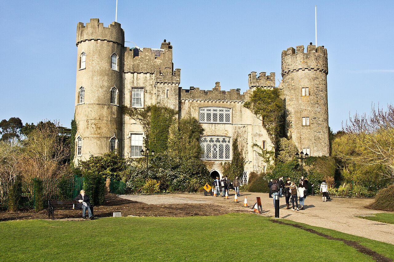
Malahide castle erected on a elevated situation in the present grounds of the Demesne is associated with the Talbot family who were granted these lands by Henry II in 1174. The family remained here until 1973, except for a short period in 1653 when Talbot was outlawed and the castle and lands were given to Miles Corbet but later restored in 1665 (Anon 1914, 255-257). It is large, irregular, and unequal in it's height. The late medieval core of the castle is largely masked by a re-build c. 1760, which involved the construction of a long symmetrical wing with corner towers that enclosed the earlier castle thus creating a castellated structure. Externally this is of Georgian Gothic style. The castle was re-roofed and renovated in the 19th-century. The ground floor of the late medieval core is vaulted and entered by a Gothic doorway, the upper chambers are approached by a spiral staircase in a SE angle tower which projects in the E. On the first floor adjoining the hall in the medieval core of the castle is the Oak Room. This has a vaulted undercroft and corbel heads of Edward 1V, which are original (Dims L10.75m, Wth 7.15m, T 1.30m). It's walls are covered with carved panelling of 16th-century date. There is a 16th-century Flemish carving over the fireplace depicting the Assumption of the Virgin (Flanagan 1984, 25-29; Bence-Jones 1988, 198-199, O'Shea 1992, 12).
Fingal County Council undertook an extensive restoration and conservation project in 2010/2011. Archaeological testing and excavation (Consent no. C451) in advance of wheelchair access insertion uncovered a set of steps at the north-west corner of the older part of the castle, an early possible enclosing wall identified below the Butler’s House as well as a substantial ditch (1.7m in width), which was sealed by the likely late medieval courtyard and probably originally enclosed the 15th-century tower house.
Compiled by: Geraldine Stout
Updated by: Christine Baker
Date of upload: 16 January 2015
The monument record does not grant public access. Check the route and ask the landowner before entering private land.