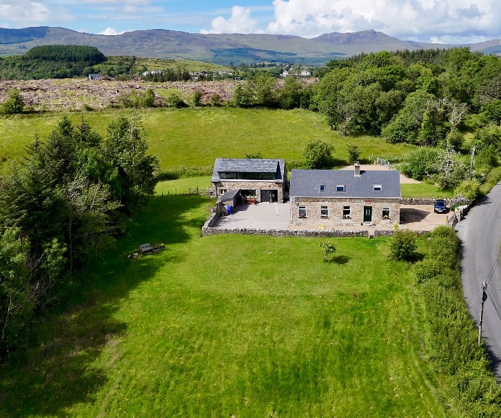
Add your own picture and explain the route, parking, gates, paths or landmarks that help people find it.
Earn 5 points after the picture is checked and accepted.
Add your photo and local directionsShare what you foundWhat is recorded here
There is now no sign above ground of the 'Fort' marked on the 1st edition of the OS 6-inch map. The 2nd edition shows it to have been partially destroyed by road building. It was situated on the W slope of a hill in good land and the local topography would suggest an earthen enclosure.
The above description was derived from the 'Archaeological Survey of County Donegal. A description of the field antiquities of the County from the Mesolithic Period to the 17th century.' Compiled by: Brian Lacey with Eamon Cody, Claire Cotter, Judy Cuppage, Noel Dunne, Vincent Hurley, Celie O'Rahilly, Paul Walsh and Seán Ó Nualláin (Lifford: Donegal County Council, 1983). In certain instances the entries have been revised and updated.
Date of upload: 22 September 2008
Excavation licence numbers 02E1629, 02E1630, 02E1631
Testing was carried out before proposed road-construction works on the N56 Road Realignment Scheme between Mountaintop and Illistrin, Co. Donegal. The proposed works involve the improvement of the existing N56 over a distance of 4-5km, in the townlands of Carnamogach Lower, Carnamogach Upper, Ballaghderg, Fallard or Calhame, Illistrin (sometimes spelt Ellistrin) Little and Coolboy Big. Fieldwork was carried out from 29 October to 13 November 2002, on behalf of Donegal County Council and the National Roads Authority. It is proposed that the road be realigned between Mountaintop, a northern suburb of Letterkenny, at the top of a low mountain ridge at c. 153m OD, and Illistrin Little, at the bottom of the mountain at c. 33m OD. Testing was carried out in twelve fields along the route. In Field 1 (21745 41523, SMR 53:8, 02E1631) a circular enclosure is shown on the first-edition OS 6-inch map but does not appear on subsequent editions, and so it is presumed to have been levelled in the interval. The remains of a possible ringfort were found in the form of two wide, truncated ditches in the northern part of the field, with undated occupation remains lying adjacent to the south, probably outside of the former enclosure. In Field 6 (21735 41575, 02E1630) the first-edition OS 6-inch map shows several buildings along a winding lane, beside a stream known to have supported historical milling operations. Testing revealed no evidence of these buildings or any other archaeological remains. No significant archaeological remains were identified in any of the other ten fields tested (02E1629). (Excavations Bulletin 2002)
Angus Stephenson, AOC Archaeology Group Ltd, St Margaret's Business Centre, Moor Mead Road, Twickenham, London TW1 1JS.
Excavation licence No. 04E1708
An excavation was carried out at the site of a levelled ringfort at Ballaghderg, Co. Donegal, in advance of a proposed road realignment (N56 Mountaintop-
Illistrin) outside Letterkenny. The Archaeological Survey of County Donegal (Lacey 1983, 198) noted that the site was no longer visible aboveground, although it was extant when the OS first surveyed the area in 1835. Road improvements in the mid-19th century caused partial, though substantial, destruction and the monument was not included on the third-edition map (1905). Ploughing, land improvements and prolonged soil creep had removed any surface indication of the site, which was situated on a west-facing hill slope with commanding views to the north and north-west. Following a site inspection, the extent of the ringfort was delimited as a curving line of mature ash trees on the western side of the N56, despite much of the area having been reclaimed through the dumping of construction waste. The modern N56 from Letterkenny to Dunfanaghy preserves the most direct route from the early medieval monastic site of Kilmacrenan to those at Raphoe and Derry, through a natural pass in the highlands north-west of Letterkenny.
The site was separated into two areas of excavation on either side of the N56. Area 1 measured c. 50m north-south by 8m and was the subject of testing by Angus Stephenson in 2002 (Excavations 2002, No. 430, 02E1629-31). Area 2 was identified during the excavation phase as a curving line of mature trees flanking a shallow depression on the west side of the N56. An area c. 20m by 10m was stripped of topsoil and reclamation deposits, revealing archaeological stratigraphy at a depth of 2m below present ground level.
The principal feature within Area 1 was a short length of ditch cut into natural subsoil to a depth of 1.1-1.4m. It extended beyond both the eastern and western limits of excavation and measured 3-3.5m wide. On the northern side the cut was defined by a sharp break of slope and steep sides leading to an occasionally concave but generally flat base. The southern side was less straightforward, where a small step was apparently incorporated. The southern side was truncated by a later soakaway. The ditch at this location contained a clear-cut stratigraphic sequence, beginning with an accumulation of basal silt, followed by a build-up of occupational debris that contained occasional flecks of unidentified animal bone, moderate charcoal inclusions (exclusively willow, with a single example of oak), charred hazelnut shells (Corylus avellana L.), charred bark and a possible charred pronotum of a weevil (Curculionidae sp. indet.). Two charred caryopses of a representative of the grass family (Poaceae) were too poorly preserved for further identification. Charcoal from this occupation deposit was dated to the period AD 690-900. These lower deposits were sealed by a slipped internal bank deposit and subsequently by alternating clay and silt layers.
Evidence of the inner bank remained well beneath ground level as a small mound of reddish-orange redeposited subsoil, which survived to a height of 0.25m, upcast from the excavation of the ditch. It was a maximum of 5m wide at the base, although this may be due in part to slip on both sides. Other features in this area included shallow drains and a possible post-hole located beyond the enclosing ditch.
The enclosing ditch was seen to continue into Area 2 from Area 1 and extend to the north-east into a neighbouring plot. There were no other archaeological features recorded. The topography of the site in Area 2 necessitated a change in ditch morphology. The excavated material probably formed a bank at the top of a natural scarp. It appeared that the original site was situated on a small plateau overlooking a river valley. At 0.4m deep, the cut was not as deep as Area 1; its location at the base of a natural scarp enhanced its defensive properties. Four deposits were recorded within the cut but contained no environmental or cultural material (Excavations 2005).
Reference
Lacey, B. 1983 Archaeological Survey of County Donegal. Donegal County Council, Lifford.
Robert O'Hara, Archaeological Consultancy Services Ltd, Unit 21, Boyne Business Park, Greenhills, Drogheda, Co. Louth.
The monument record does not grant public access. Check the route and ask the landowner before entering private land.