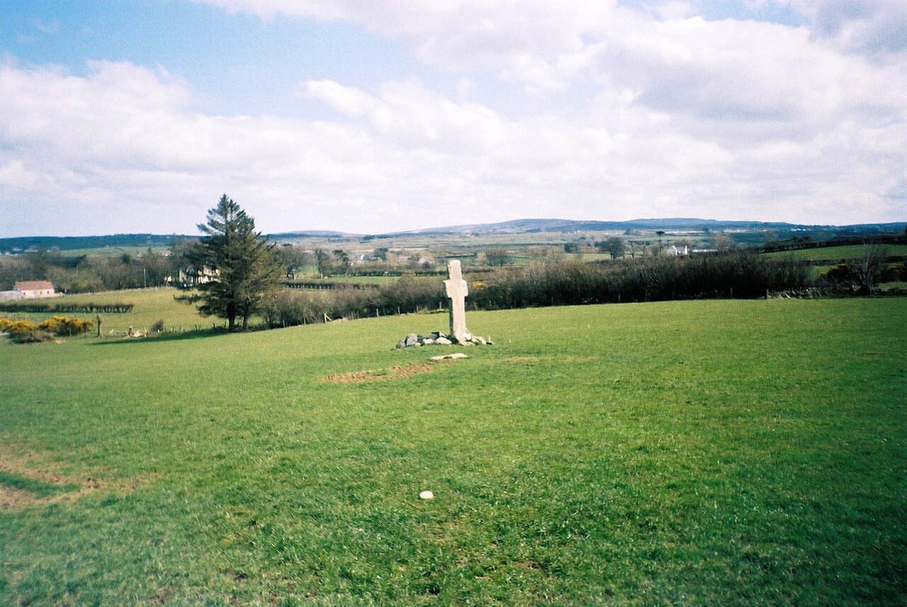
Add your own picture and explain the route, parking, gates, paths or landmarks that help people find it.
Earn 5 points after the picture is checked and accepted.
Add your photo and local directionsShare what you foundWhat is recorded here
Carrowmore ecclesiastical complex has been identified with Both Chonais an early monastic site (Gwynn and Hadcock 1970, 30). The site consists of a series of monuments (DG011-049----/049010-) divided by a modern road, but obviously it originally formed part of a larger unit. On the W side of the road there is a rectangular enclosure of a burial ground (DG011-049001-). Near the SW corner of the enclosure two jamb-stones 1.5m apart, and at right-angles to the line of the wall, probably indicate an entrance. Just beyond the N side of this wall is a flat-topped boulder (DG011-049003-) which may be the base of a high cross. Inside the dividing wall is a possible cross-slab (DG011-049004-) partially buried in the ground. Also close to the S end is a tall plain high cross (DG011-049005-). E of the road is a second high cross (DG011-049006-) standing 2.8m high and 1.3m wide at the arms. At the top of this cross is a very indistinct trace of a standing figure flanked by two angel-like figures. This cross often referred to as the South Cross was described by Harbison (1992, 33) as following: 'A ringless cross, 2.85m high and measuring 1.35m across the arms, stands in a field adjacent to the National School. The shaft is 77cm wide and 20cm thick. The east face is plain. WEST FACE MAJESTAS DOMINI - (Rowan-an angel), Cut out in low false relief on the upper part of the west face is a figure of Christ, clothed in a cut-away garment and with his feet in profile. He is flanked on each side by an angel in profile.'
There is a small cairn (DG011-049007-) possibly a penitential cairn of stones about the base of the cross. This cairn is marked on the 1903 ed. OS 6-inch map (Lacy et. al. 1983, 248). 18m to the S there is an earth-fast cross-inscribed boulder (DG011-049008-). To the NE against a field and townland boundary there was a holy well (DG012-021---) which has been closed up (Ó Muirgheasa, No. 94). In 2012 the Bernician Studies Group carried out a magnetometer survey in the fields surrounding the high crosses (DG011-049005-/006-) at Carrowmore which revealed the sub-surface remains of a bi-vallate early Christian ecclesiastical enclosure (DG011-049----) (O'Brien and Adams 2014, 4). The magnetometer survey shows that the South Cross stands outside the outer enclosing element of the ecclesiastical enclosure.
The above description was derived from the 'Archaeological Survey of County Donegal. A description of the field antiquities of the County from the Mesolithic Period to the 17th century.' Compiled by: Brian Lacey with Eamon Cody, Claire Cotter, Judy Cuppage, Noel Dunne, Vincent Hurley, Celie O'Rahilly, Paul Walsh and Seán Ó Nualláin (Lifford: Donegal County Council, 1983). In certain instances the entries have been revised and updated.
Compiled by: Caimin O'Brien
Date of revised upload: 4 March 2015
The monument record does not grant public access. Check the route and ask the landowner before entering private land.