Add your own picture and explain the route, parking, gates, paths or landmarks that help people find it.
Earn 5 points after the picture is checked and accepted.
Add your photo and local directionsShare what you foundWhat is recorded here
Carrowmore ecclesiastical complex has been identified with Both Chonais an early monastic site (Gwynn and Hadcock 1970, 30). The monastery is located on good land sloping gently to the N. On the NW, the edge of the site is defined by a sharp drop to the Carrowmore River.
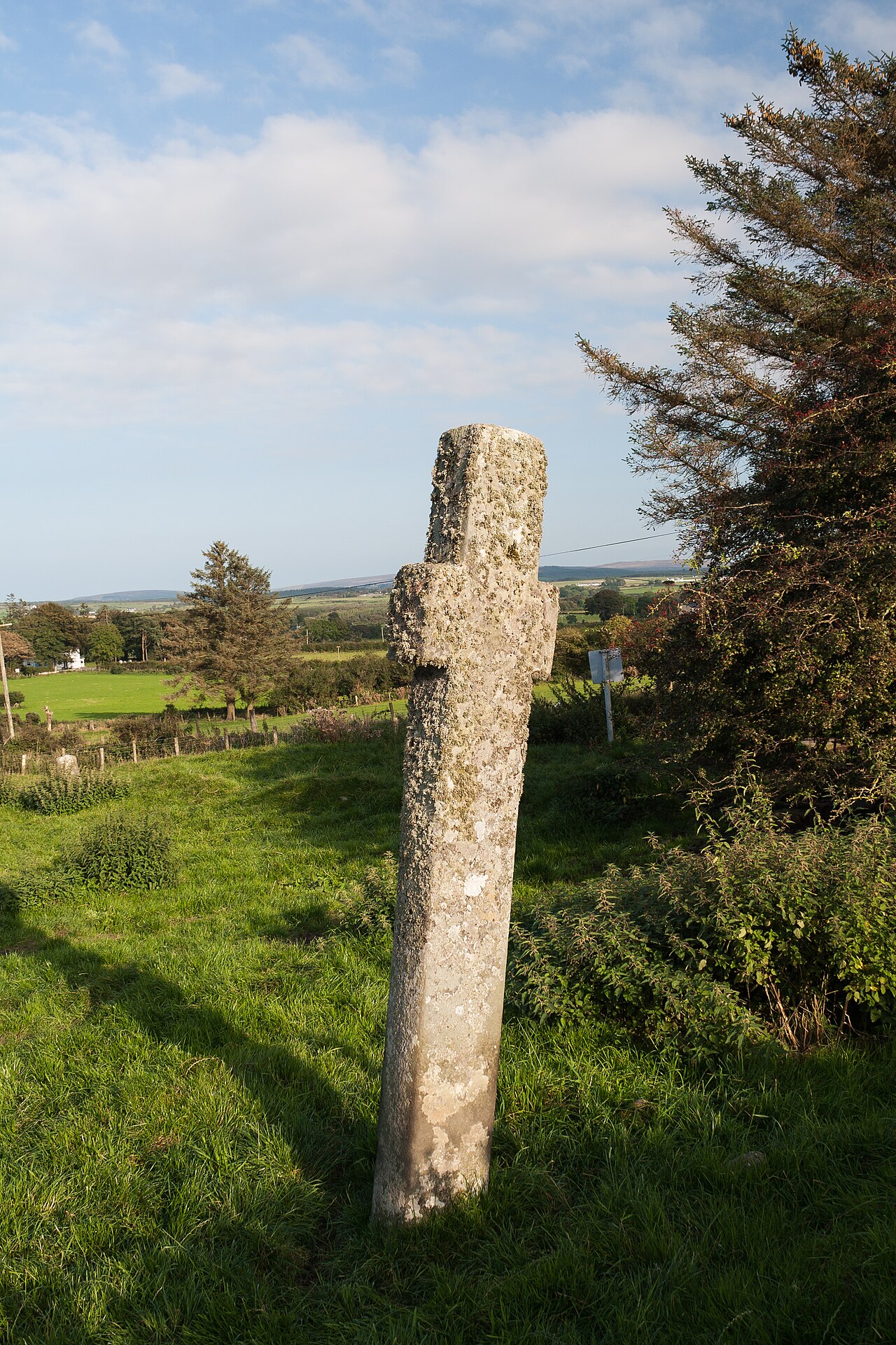
The site consists of a series of monuments (DG011-049----/049010-) divided by a modern road, but obviously it originally formed part of a larger unit. On the W side of the road there is a rectangular enclosure of the graveyard (DG011-049001-) defined on the SE and SW by modern field boundaries and by the road, and on the NW and NE by a low, grassed-over stone wall. Near the SW corner of the enclosure two jamb-stones (DG011-049002-) 1.5m apart, and at right-angles to the line of the wall, probably indicate an entrance. Just beyond the N side of this wall is a flat-topped boulder (DG011-049003-) which may be the base of a high cross. Inside the dividing wall is a possible cross-slab (DG011-049004-) partially buried in the ground. Also close to the S end is a tall plain cross (DG011-049005-). E of the road is a second cross (DG011-049006-). There is a small cairn (DG011-049007-) possibly a penitential cairn of stones about the base of the cross. This cairn is marked on the 1903 ed. OS 6-inch map (Lacy et. al. 1983, 248). 18m to the S there is an earth-fast cross-inscribed boulder (DG011-049008-). To the NE against a field and townland boundary there was a holy well (DG012-021---) which has been closed up (Ó Muirgheasa, No. 94).
In 2012 the Bernician Studies Group carried out a magnetometer survey in the fields surrounding the high cross at Carrowmore which revealed the sub-surface remains of a bi-vallate early Christian ecclesiastical enclosure (O'Brien and Adams 2014, 4). The precinct boundary consists of an inner enclosure (diam. 60m) with a second outer enclosing element (diam. 115m) following the line of the inner enclosure. Both enclosing elements run off the ravine of the Carrowmore River which forms the enclosing element of the monastery from W to N. The magnetometer survey revealed a gap (Wth c. 10m) in NE quadrant which may be the remains of a possible entrance gap. The E cross (DG011-049006-) stands c. 15m outside the possible entrance through the outer monastic enclosure. The W cross (DG011-049005-) stands close to the centre of this ecclesiastical enclosure. An excavation trench (dims. 2m x 10m) was opened up the line of the inner enclosure on the SW side and a second trench (dims. 2m x 10m) across the outer enclosing element on the S. This latter trench revealed the ‘U’-shaped
profile of the outer ditch of the monastic precinct and was described as measuring '3.6 metres wide at the top and greater than 1.6 metres deep below the present ground surface. (Safety considerations prevented excavation to its full depth.) The primary fills suggest natural silting of an open cut, but large boulders occupied the middle reaches of the fills, possibly from the collapse or slighting of a revetment or retaining wall. A thin turfy layer above the primary fills has yielded a calibrated radiocarbon date of AD670-870. A stone-lined hearth with laminations of ash, burnt soil and charcoal, and containing ferrous slag derived from small-scale iron working was placed on the top of the ditch fills. This feature provided a calibrated radiocarbon date of AD1030-1160, effectively a terminus ante quem for the whole ditch sequence. The inner boundary was tested by excavation on the south side, west of the road. This had an ankle-breaking ‘V’ profile, some 2 metres wide at the top and cut to a depth of 1.55 metres below modern ground surface. Primary fills were again from natural silting, with organic matter in the middle zones. The ditch was then re-cut and its first subsequent fill yielded a calibrated radiocarbon date of AD590-660; the next zone of fills included stone rubble, metalworking debris and a set of small, round pebbles, probably gaming counters, in what seems to be deliberate deposition. A revetment was set back from its inner edge, with linear cut-features and stakeholes in between. When the ditch was fully filled, it was covered over as part of a more extensive cobbled surface' (O'Brien and Adams 2014, 4-5).
Attached image (DG011-049----_01.jpg) supplied courtesy of Colm O'Brien and Max Adams of the Bernician Studies Group (O'Brien and Adams 2014, 4).
Compiled by: Caimin O'Brien
Date of upload: 3 March 2015
The monument record does not grant public access. Check the route and ask the landowner before entering private land.