Add your own picture and explain the route, parking, gates, paths or landmarks that help people find it.
Earn 5 points after the picture is checked and accepted.
Add your photo and local directionsShare what you foundWhat is recorded here
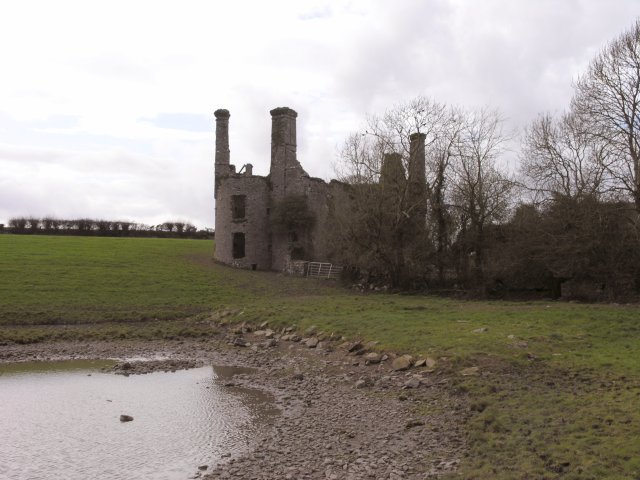
In low-lying rolling pasture, close to inlet of Owennacurra estuary; house site partially cut into slope on W side. Two storey house with attic, now roofless and partially ruined; interior overgrown; remains of ancillary buildings on NE side. House consists of rectangular block (16m N-S; 6.5m E-W) with rectangular projection (4.2m E-W; 3.6m N-S) just S of centre on W wall, and circular towers at NE and SW corners (int. diam. 3.8m). Walls of house stand to full height except N end of W wall and parts of N gable, which have collapsed. Front elevation faces E: 3-bay, 2-storey, with central ground floor door; as with rest of house all window and door surrounds gone. Large rectangular chimney stack atop main S gable and on both circular towers; photo in Coleman (1915, facing 158) shows similar stack atop N gable, now fallen. Each stack fed by fireplaces on each floor; most missing lintel and breast. Window opes in circular towers smaller than main block; each tower has a number of gun loops at ground level. Ruinous ancillary buildings to N; W wall in line with W wall of house, extending E where section still roofed (probably a re-roofing in 18th/19th century). Two large chimney stacks, similar to those on house, rise from E gable of roofed section and in NW corner, latter fed by large fireplace with remains of circular, domed bread oven on N side; probably part of kitchen for house. Surrounding fields contain some garden/demesne features which may be contemporary with house or with adjacent 18th century house (CO076-020004-).To SW is rectangular field with curved features at either end; that at SW end has two tall limestone columns flanking dressed-stone wall with niches; possibly remains of ornamental garden (CO076-020001-). House apparently built by Cromwellian settler Sir John Broderick around 1650, probably on site of earlier Hodnett castle (Coleman ibid., 162-5).
The above description is derived from the published 'Archaeological Inventory of County Cork. Volume 2: East and South Cork' (Dublin: Stationery Office, 1994). In certain instances the entries have been revised and updated in the light of recent research.
Date of upload/revision: 14 January 2009
The monument record does not grant public access. Check the route and ask the landowner before entering private land.