Add your own picture and explain the route, parking, gates, paths or landmarks that help people find it.
Earn 5 points after the picture is checked and accepted.
Add your photo and local directionsShare what you foundWhat is recorded here
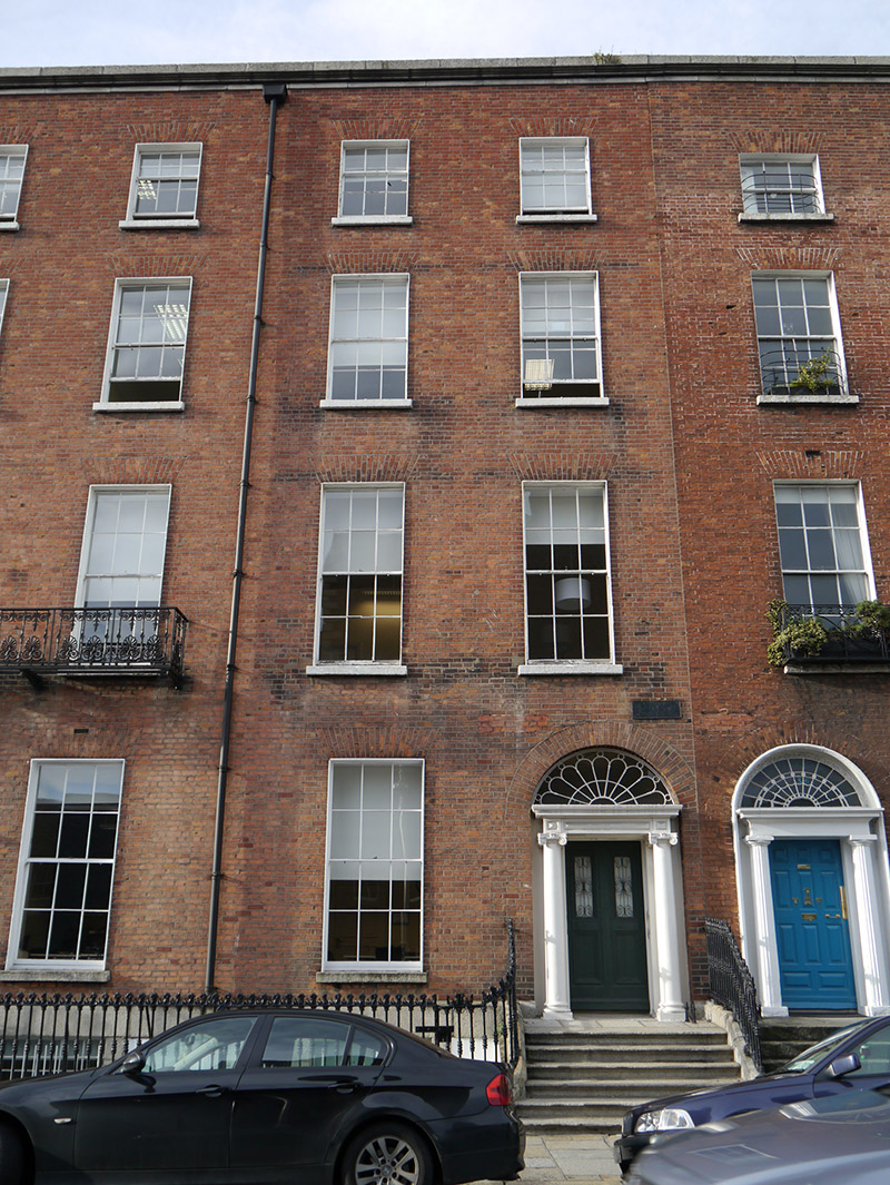
Terraced two-bay four-storey over basement former townhouse, built c. 1830, with bowed bay and two-stage return to rear (west). Now in use offices. Replacement mansard-style roof, concealed by parapet with moulded granite cornice and coping. Parapet gutters with uPVC downpipe to south side. Red brick walling laid in Flemish bond over ruled-and-lined rendered walling to basement beneath granite stringcourse. Square-headed window openings with brick voussoirs, patent reveals and granite sills; granite surrounds to basement opening with cast-iron grille affixed to reveals. Largely six-over-six sliding timber sash windows with cavetto or convex horns, three-over-six to third floor and ten-over-ten to basement. Round-headed door opening with brick voussoirs and recessed surround containing prostyle portico with nail-head panelled frieze and moulded cornice carried on Scamozzian-Ionic columns over plinth stops, with petal fanlight and replacement (possibly early-twentieth century) timber and glass panelled door with decorative iron work fronting upper glazed panels. Granite entrance platform with cast-iron boot scraper approached by six bull-nosed granite steps, flanked by curved iron railings with decorative cast-iron finials and collars on granite plinth, enclosing basement well to south. Coal-hole cover to pavement. Recent brick boundary wall to Laverty Close.
This official record and map point do not grant access. Most recorded buildings are privately owned; view them only from public ground unless the owner allows entry.