Add your own picture and explain the route, parking, gates, paths or landmarks that help people find it.
Earn 5 points after the picture is checked and accepted.
Add your photo and local directionsShare what you foundWhat is recorded here
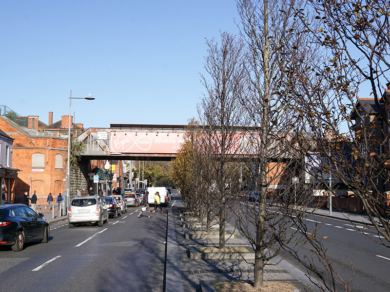
Single-span railway bridge, erected c. 1900, originally carrying Kingsbridge to Amiens Street railway line and now in use by Maynooth and Longford commuter line. Rusticated limestone abutments and piers with rusticated limestone copings, supporting box-truss steel girder superstructure and balustrade with recent signage. Battered rendered approach walls with render stringcourse and channelled pilasters. Railway station (Drumcondra) incorporated into west abutment and having flat roof concealed behind red brick parapet, red brick walling laid in Flemish bond, with cut limestone stringcourses, coping, and capping to red brick plinth course, and segmental-headed window, door and blind openings with moulded brick surrounds. Bridge crosses Drumcondra Road Lower, near junction with Clonliffe Road.
This official record and map point do not grant access. Most recorded buildings are privately owned; view them only from public ground unless the owner allows entry.