Add your own picture and explain the route, parking, gates, paths or landmarks that help people find it.
Earn 5 points after the picture is checked and accepted.
Add your photo and local directionsShare what you foundWhat is recorded here
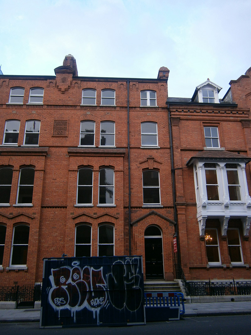
Terraced two-bay four-storey house over basement, dated 1881 as one of pair. Two-storey box-bay to front (west) elevation. Hipped T-plan roof, with shared red brick profiled chimneystacks, brick parapet having cut stone coping, eaves course with corbelled arch heads, and cast-iron rainwater goods. Segmental pediment to brick plaque (shared with No. 15) at eaves level, having stepped profile corbels and terracotta panel with raised monogram. Red brick, laid in English garden wall bond, to walls, snecked squared stone plinth course with cut granite capping. Brick stringcourses and vertical brick sawtooth course. Raised terracotta plaque reading 'Earlsfort Terrace 1881'. Carved brick cornice to box-bay. Decorative vent bricks. Segmental-headed window openings, paired to box-bay, with stepped brick voussoirs and granite sills. Some brick keystones and carved brick hoods. One-over-one pane timber sliding sash windows throughout. Shallow gable-fronted porch having terracotta coping. Round-headed door opening with terracotta footstalls, timber panelled door and plain fanlight. Nosed granite steps, leg of boot-scrape to platform, flanked by cast-iron balustrade on granite plinth walls. Square-headed door opening beneath steps. Basement area enclosed by carved granite plinth wall and cast-iron panel railings. Matching gate. Squared stone wall with granite coping to basement area boundary wall. Coal-hole cover set in granite slab to front pavement. Set back from street.
This official record and map point do not grant access. Most recorded buildings are privately owned; view them only from public ground unless the owner allows entry.