Add your own picture and explain the route, parking, gates, paths or landmarks that help people find it.
Earn 5 points after the picture is checked and accepted.
Add your photo and local directionsShare what you foundWhat is recorded here
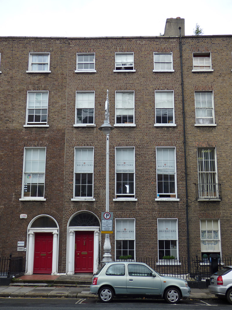
Attached three-bay four-storey former house over basement, built c. 1780 as pair with No. 6, and having single and two-storey return to rear of south bay. Now in use as offices. M-profile pitched slate roof, hipped to south end, with further shared roof to part of valley, behind parapet with granite coping. Rendered chimneystacks to north party wall with terracotta pots; concealed rainwater goods. Flat roofs to return. Flemish bond brown brick walling on painted masonry plinth over painted rendered basement walling. Square-headed window openings, diminishing in height to upper floors, with patent reveals and painted masonry sills. Timber sliding sash windows without horns (except for one top floor window), three-over-three pane to top floor and six-over-six pane elsewhere. Steel grilles to basement at front. Round-headed door opening with painted masonry doorcase, having moulded rendered surround, moulded cornice and fluted frieze with rosettes over Adamesque Ionic columns, replacement leaded fanlight and nine-panel raised-and-fielded timber door with replacement brass furniture. Inclined granite platform with iron boot-scrape. Plainly detailed door opening beneath entrance platform with recent door and window. Basement area enclosed by wrought-iron railings with decorative cast-iron posts on painted moulded granite plinth. Yard to rear, and later buildings to rear of plot. Cast-iron coal-hole cover to pavement.
This official record and map point do not grant access. Most recorded buildings are privately owned; view them only from public ground unless the owner allows entry.