Add your own picture and explain the route, parking, gates, paths or landmarks that help people find it.
Earn 5 points after the picture is checked and accepted.
Add your photo and local directionsShare what you foundWhat is recorded here
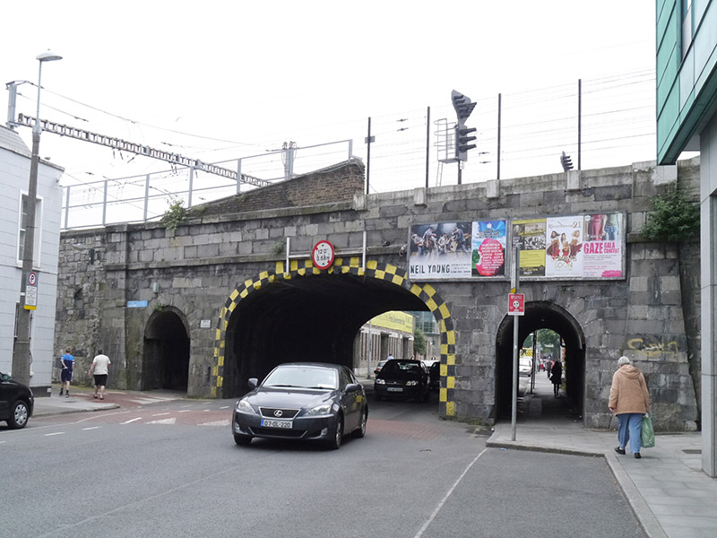
Railway bridge, built c. 1833, carrying railway over Sandwith Street Upper, comprising elliptical-headed vehicular archway flanked by lower round-headed pedestrian archways. Extended to south c. 1960. Tool-faced ashlar limestone walling with projecting cut limestone stringcourse and coping to north parapet. East part of north parapet surmounted by later brick wall, and west part has replacement concrete coping. North elevation terminated to east and west by tapered piers, abutted by random ashlar limestone walls. Projecting rock-faced coursed ashlar limestone walls to either side of south elevation, extending southward and featuring pair of high-level round-headed openings to west with machine-made red brick surrounds and steel grilles affixed, and single round-headed former door opening, with rock-faced stone architrave and infilled with machine-made brick and having single opening with iron grille affixed. Southern extension comprises boxed-in steel lattice-trusses and steel rails, carried over flanking south walls, with pair of reinforced concrete piers fronting south elevation of original 1830s bridge. Abutted to south by associated water tower.
This official record and map point do not grant access. Most recorded buildings are privately owned; view them only from public ground unless the owner allows entry.