Add your own picture and explain the route, parking, gates, paths or landmarks that help people find it.
Earn 5 points after the picture is checked and accepted.
Add your photo and local directionsShare what you foundWhat is recorded here
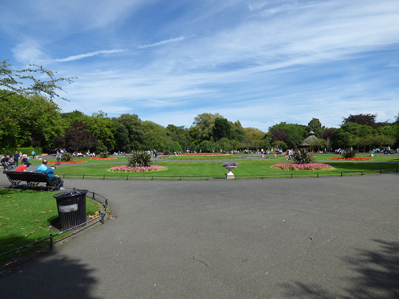
Rectangular-plan urban park, established c. 1664, laid out anew 1814-18 and re-landscaped as public park c. 1877. Principal entrance gates at corners, with secondary entrances along middle of sides. Central formal parterre comprising concentric grass lawns and planting beds, axial tarmacadam paths, terminated to east and west by matching ornamental fountains, having oriental pagodas behind. Backdrop of mature planting to perimeter of parterre, informal landscaping arrangement to edges, primary perimeter path lined with mature planting, intersected by various winding paths creating grass lawned areas interspersed with mature planting. Concentration of tall planting to north and west, open heath to south and east. Large ornamental lake located towards north, spanned by rubble stone bridge (named for Daniel O'Connell), with timber pavilion to north side. Bandstand located south of central parterre, Royal Dublin Fusiliers Arch located at northwest corner, Art-and-Crafts-style gate lodge to southwest corner, Wolfe Tone Memorial located at northeast corner. Series of memorials and statues throughout. Park surrounded by pedestrian footpath with historic bollards and lamp standards, and roadways, latter fronted by rows of Georgian and later buildings, and approached from north by various busy shopping streets. Park bounded by cast-iron railings with spearhead finials atop low moulded granite plinth. Entrances at northwest (Fusiliers' Arch), at northeast (backdrop to Wolfe Tone memorial) and to southeast have separate records. Gateway at southwest, next to Superintendent's Lodge, has double-leaf vehicular gate of similar detailing to railings, flanked by openwork cast-iron piers with decorative wrought-iron panel to front face and decorative wrought-iron openwork finial, atop moulded plinth that is slightly higher than that to railings. Public toilets of 1929 in northwest part of park, south of Fusiliers Arch. Lines of freestanding octagonal-plan granite bollards, erected c. 1818, lining outer perimeter of Saint Stephen's Green and fronting kerbstones of footpath. Comprising plinths with tapered corners, octagonal domed tops surmounted by pointed round wrought-iron finials over projecting chain fixing points. Bollards originally all having iron chains strung between.
This official record and map point do not grant access. Most recorded buildings are privately owned; view them only from public ground unless the owner allows entry.