Add your own picture and explain the route, parking, gates, paths or landmarks that help people find it.
Earn 5 points after the picture is checked and accepted.
Add your photo and local directionsShare what you foundWhat is recorded here
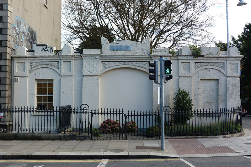
Corner-sited three-bay single-storey former carriage-archway, built c. 1830, with single-storey flat-roofed twentieth-century block to rear. Segmental-headed archway to centre, now infilled and in use as offices, with foliate ornament to spandrels and flanked by pilasters, in turn flanked by narrower segmental-headed recesses (north-western having window and southwestern being blind) and flanked by pilasters. Flat roof concealed behind painted moulded granite eaves cornice with pediment details, with cast-iron rainwater goods to rear elevation. Rendered brick walls. Square-headed window opening to northwest end has rendered reveals, painted granite sill and six-over-six pane timber sliding sash window lacking horns; similar window to rear has horns. Decorative cast-iron railings to front, on carved granite plinth, with similar double-leaf gate to middle, enclosing garden area. Located on north side of Baggot Street Lower at junction with Herbert Place, abutted by No. 73 to northwest.
This official record and map point do not grant access. Most recorded buildings are privately owned; view them only from public ground unless the owner allows entry.