Add your own picture and explain the route, parking, gates, paths or landmarks that help people find it.
Earn 5 points after the picture is checked and accepted.
Add your photo and local directionsShare what you foundWhat is recorded here
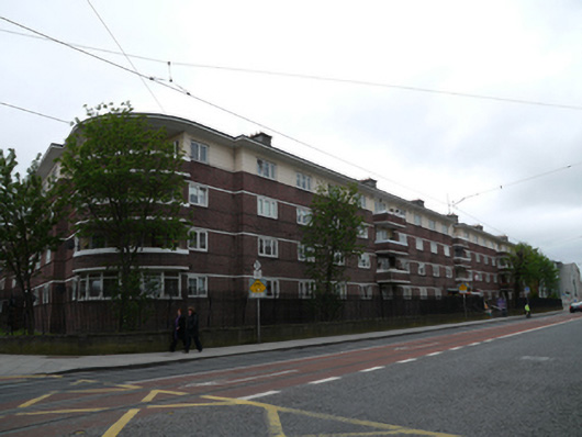
Detached C-plan multiple-bay four-storey social housing apartment building, built c.1940, having curved corners with partly recessed balconies to north-west, north-east and south-east corners, projecting balconies to front (north) elevation of north block, and front (south) elevation of south block. Deck access and stair towers to courtyard elevations. Retail units to centre ground floor of front elevation of north block. Flat roofs with projecting eaves and rendered chimneystacks. Raised rendered parapets to front and rear of centre of front, west and rear blocks. Red brick walls laid in Flemish bond to front elevations with rendered string courses and channelled render to third floor. Roughcast rendered walls to courtyard elevations, roughcast rendered parapet walls to access decks. Painted concrete walls to stair towers. Square-headed window openings with replacement uPVC windows. Square-headed door openings to rear decks having part-glazed timber doors. Integral carriage opening to centre of west block, now boarded-up with metal panels. Some replacement uPVC doors. Set back from street, boundary having metal railings on masonry plinth with granite capping. Concrete steps to front from footpath to retail units at raised ground floor level. Hard surfacing to central courtyard accommodating car parking and playground. Associated L-plan block to east side of Basin Street Lower.
This official record and map point do not grant access. Most recorded buildings are privately owned; view them only from public ground unless the owner allows entry.