Add your own picture and explain the route, parking, gates, paths or landmarks that help people find it.
Earn 5 points after the picture is checked and accepted.
Add your photo and local directionsShare what you foundWhat is recorded here
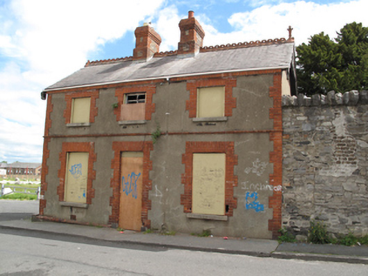
Detached three-bay two-storey sexton's house, built c.1880, having single-storey flat-roofed extension to south elevation. Now disused. Pitched slate roof having terracotta ridge crestings and finial, having exposed timber end trusses, red brick chimneystacks, red brick eaves course and some cast-iron rainwater goods. Yellow brick walls laid in Flemish bond, having moulded red brick string course and plinth course, red brick quoins to all elevations, rendered walls to front (west) and south elevations. Square-headed window openings having cut stone sills, red brick block-and-start surrounds, all openings blocked, timber sash window evident in first floor opening to front elevation. Square-headed door openings to front and rear (east) elevations, having red brick block-and-start surrounds, all openings blocked, granite plinth blocks and steps to rear elevation opening. Located on street, within boundary of Goldenbridge Cemetery, having rear access from cemetery grounds and small yard with shed to south, having castellated brick walls, partially rendered. Square-profile granite War Department bollard to north-east corner of house.
This official record and map point do not grant access. Most recorded buildings are privately owned; view them only from public ground unless the owner allows entry.