Add your own picture and explain the route, parking, gates, paths or landmarks that help people find it.
Earn 5 points after the picture is checked and accepted.
Add your photo and local directionsShare what you foundWhat is recorded here
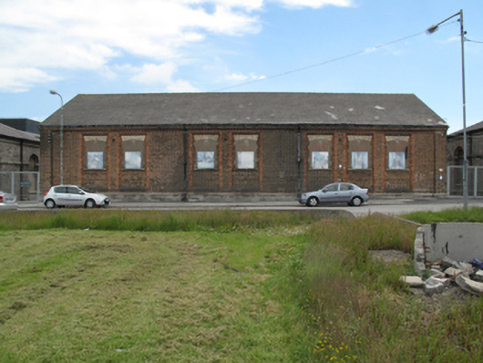
Detached seven-bay single-storey former barracks, built c.1850, having attic accommodation to south end and single-storey flat-roofed extension to rear (east) elevation. Later in use as social housing, subsequently in use as school, currently disused. Pitched slate roof having decorative polychrome eaves course, some cast-iron rainwater goods. Yellow brick walls laid in English bond over chamfered granite and limestone, square-headed recessed panels to north elevation having chamfered red brick reveals, dentilated polychrome brick head detail and chamfered sills. Segmental-headed window openings to front (west) and south elevations, having yellow brick voussoirs and cut granite sills, set within square-headed recesses. Blocked window openings to front elevation, timber sash windows to south elevation, ground floor. Segmental-headed door opening to south elevation having yellow brick voussoirs, square-headed door opening to north elevation having concrete lintel. Located on street between two surviving barracks buildings, addressing the site of recently demolished Saint Michael’s Estate housing complex.
This official record and map point do not grant access. Most recorded buildings are privately owned; view them only from public ground unless the owner allows entry.