Add your own picture and explain the route, parking, gates, paths or landmarks that help people find it.
Earn 5 points after the picture is checked and accepted.
Add your photo and local directionsShare what you foundWhat is recorded here
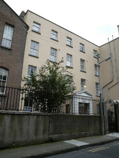
Attached five-bay four-storey over basement former convent, built 1788, having pedimented entrance porch to front (west) elevation and over full-height advanced central bay to rear elevation. Now in use as supported housing. Pitched and hipped roofs having granite coping to parapets. Rendered chimneystacks. Lined-and-ruled rendered walls with granite string course at ground floor level. Square-headed window openings having timber sash windows, with three-over-six panes to fourth floor, six-over-six panes to lower floors of front elevation, mixed six-over-six and two-over-two panes to rear elevation. Round-headed window opening to first floor over rear entrance having stained glass window. Pedimented channelled rendered front entrance porch having square-headed door opening. Square-headed door opening with timber panelled door with sidelights and overlights. Porch to rear elevation having hipped glazed roof and leaded glazing to internal elevations, approached by steps over area flanked by cast-iron railings. Wrought-iron arch on cast-iron piers with cherub finial. Steps to basement with wrought-iron railings with cast-iron panels. Set back from street having front garden enclosed by rendered walls with wrought-iron railings over. Rendered entrance piers having wrought-iron arch over double-leaf pedestrian entrance gate.
This official record and map point do not grant access. Most recorded buildings are privately owned; view them only from public ground unless the owner allows entry.