Add your own picture and explain the route, parking, gates, paths or landmarks that help people find it.
Earn 5 points after the picture is checked and accepted.
Add your photo and local directionsShare what you foundWhat is recorded here
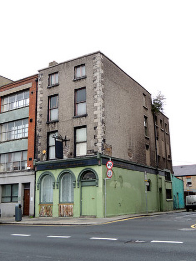
End-of-terrace two-bay four-storey former house, built c.1720, with lower three-bay return to rear, and later shopfront to front elevation. Formerly also in use as public house. Now in use as flats. M-profile hipped artificial slate roof with terracotta ridge tiles. Cement rendered chimneystack with replacement terracotta chimneypots. Roughcast rendered walls, brick exposed in places, with cut stone quoins and cement rendered coping to parapet. Wrought-iron hanging sign and cast-iron plaque to first floor of front (south) elevation 'INNS QUAY/WARD.' Square-headed window openings, with timber casement windows to third storey, one-over-one pane timber sash windows to first and second floors, each with rendered reveals and painted stone sills. Shopfront to front elevation, having recent nameplate and round-headed openings having carved stone surrounds and consoles. Plate glass windows with timber frames and sills over timber battened risers, and double-leaf timber battened doors with leaded fanlight. Painted rendered walls to shopfront, and to ground floor of east elevation. Infilled round-headed opening near corner on east elevation. Square-headed door opening to east elevation having timber panelled door with carved timber surround. Concrete paving to south elevation with some granite paving to east elevation, granite kerbstones to south and east.
This official record and map point do not grant access. Most recorded buildings are privately owned; view them only from public ground unless the owner allows entry.