Add your own picture and explain the route, parking, gates, paths or landmarks that help people find it.
Earn 5 points after the picture is checked and accepted.
Add your photo and local directionsShare what you foundWhat is recorded here
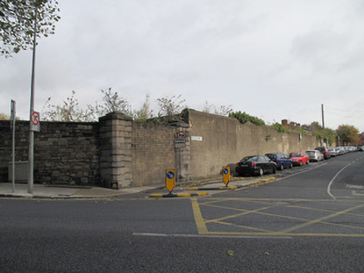
Wall and gateways around former Ordnance Stores, built c.1825, and around Isolation Hospital, built c.1880. Dressed snecked calp limestone, having block-and-start dressed limestone quoins and rounded granite coping in places, roughcast rendered to Montpelier Hill elevation. Gateway to Infirmary Road comprising pair of square-profile granite piers having chamfered corners, flanking double-leaf steel gate, square-headed pedestrian entrance to south with cut granite surround, lintel, keystone and step, single-leaf steel gate. Gateway to Infirmary Road comprising square-profile cut granite piers flanking double-leaf wrought-iron gate and matching single-leaf pedestrian gate. Gateway to corner of Montpelier Hill comprising pair of square-profile cut calp limestone piers, chamfered edges, entrance now blocked. Gateway to Montpelier Hill comprising pair of square-profile cut calp limestone piers having chamfered edges, flanking steel railing.
This official record and map point do not grant access. Most recorded buildings are privately owned; view them only from public ground unless the owner allows entry.