Add your own picture and explain the route, parking, gates, paths or landmarks that help people find it.
Earn 5 points after the picture is checked and accepted.
Add your photo and local directionsShare what you foundWhat is recorded here
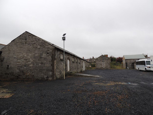
Complex of former stable and related storage buildings, built c.1800-1879, to north-west of Collins Barracks and west of former Arbour Hill detention barracks. Detached eight-bay single-storey block to south-west, built c.1850, comprising five-bay former granary abutted to north by three-bay former hay store. Pitched slate roof, cast-iron rainwater goods, and snecked dressed limestone walls having red brick quoins to south corners. Segmental-headed window openings to granary, with brown brick block-and-start surrounds and cut granite sills, having timber casement windows and metal bars. Round-headed carriage arch to east elevation of former hay store with moulded yellow brick voussoirs and cut granite block-and-start jambs. Round-headed window openings to hay store, containing two-over-two pane square-headed timber sash windows. Lunette window to north gable having cut granite sill, moulded yellow brick voussoirs, and timber louvres.Two detached twelve-bay single-storey blocks to north and north-west of yard, dated 1879, formerly used as troops’ and officers’ stables. Pitched slate roof to north-west building, roof largely missing to north building, cast-iron rainwater goods, yellow brick chimneystack, timber bargeboards and finial, dressed snecked limestone walls with brick quoins, moulded brick eaves course and plinth course. Elliptical-headed window and door openings, each with yellow brick block-and-start surrounds. Timber framed windows with cut granite sills and metal bars. Sheet metal doors. Rendered square-profile piers with steel gates to entrance to yard between buildings, to north.Single-storey former hay and straw stores to east, built c.1820, now in derelict state. Evidence for barrel roof to south-east block of range. Snecked dressed limestone boundary wall to east and south, having square-profile cut granite piers to south elevation, with replacement steel gate. Cobbled setts to south of gate, poured concrete path with granite kerbstones.
This official record and map point do not grant access. Most recorded buildings are privately owned; view them only from public ground unless the owner allows entry.