Add your own picture and explain the route, parking, gates, paths or landmarks that help people find it.
Earn 5 points after the picture is checked and accepted.
Add your photo and local directionsShare what you foundWhat is recorded here
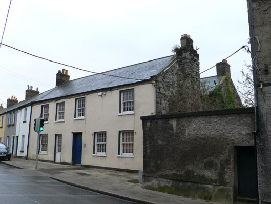
End-of-terrace two-storey two-pile house, built c.1725, having five-bay ground floor and four-bay first floor. Subsequently divided into two houses, eastern being two-bay and western being three-bay, but both units now one again, with doorway converted to timber sliding sash window. The first edition Ordnance Survey map indicates two rear returns to building. Pitched slate roof with gable-end chimneystacks, brick to east end and projecting rubble limestone rubble to west, latter topped with brick. Some evidence for earlier steeper roof in west gable. Rear pile has pitched artificial slate roof with stout brick chimneystack. Render copings to both piles. Rendered walling to front elevation and exposed limestone to west gable. Square-headed openings, with eight-over-eight pane timber sliding sash windows. Timber glazed door with limestone step.
This official record and map point do not grant access. Most recorded buildings are privately owned; view them only from public ground unless the owner allows entry.