Add your own picture and explain the route, parking, gates, paths or landmarks that help people find it.
Earn 5 points after the picture is checked and accepted.
Add your photo and local directionsShare what you foundWhat is recorded here
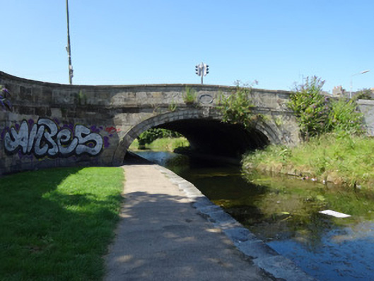
Single elliptical-arch canal bridge, built c.1790, carrying road over Royal Canal. Bridge extended to northeast to carry road over adjacent railway line. Each face of bridge has cut-stone voussoirs with vermiculated keystone. Cut-stone granite blocks to spandrels with plat-band beneath parapet. Oval name plaque reading 'Clarke’s Bridge'. Granite coping to parapet. Random-coursed Dublin calp limestone with plat-band to each abutment wall on southwest side of bridge. Abutments terminated by square-plan cut-stone piers. Abutments rise from canal level and turn at curved corners to meet the granite parapets. No abutments on northeast side of bridge. Stone setts to parts of asphalt road surface. Granite kerbstones to pavement with double kerbs on southeast side. Bronze plaque to northwest parapet reads 'Clarke’s Bridge, Droichead an Chléirigh'. Pedestrian crossing with textured paving flags to bridge. Bridge extended to northeast over railway line. Parapet extended in two phases: first using random-coursed limestone blocks, and second using concrete with limestone facing.
This official record and map point do not grant access. Most recorded buildings are privately owned; view them only from public ground unless the owner allows entry.