Add your own picture and explain the route, parking, gates, paths or landmarks that help people find it.
Earn 5 points after the picture is checked and accepted.
Add your photo and local directionsShare what you foundWhat is recorded here
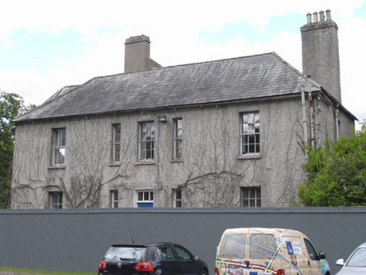
Detached former country house with basement, built 1728, having three-bay two-storey entrance front to east, three-storey seven-bay garden front to south with three-bay breakfront, flanked by two-storey wings to garden front with canted bays, and having series of gabled projections to rear. Now disused. Steeply pitched natural slate roofs (double-pile to garden front) with black clay ridge tiles and lead valleys, hipped to east and west blocks and to garden wings. Conical metal vents to ridge of westernmost block. Rendered chimneystacks of varying heights with clay pots. Cast-iron guttering on iron drive-through brackets and cast-iron downpipes. Roughcast cement rendered walls throughout. Square-headed window openings with granite sills and timber sliding sash windows with much cylinder glass, six-over-six pane to ground and first floors without horns, and two-over-two pane to canted bays and rear elevations with ogee and convex horns. Entrance bay and garden breakfront have sidelights to ground and first floors. Westernmost gable to rear abutted by flat-roofed entrance block having Venetian-style entrance with recessed porch. Southwest corner abutted by two-storey red brick wing and further single-storey wing with calp limestone walls and buff brick window surrounds with granite sills and three-over-three pane timber sliding sash windows with ogee horns. Defensive turret to south elevation of single-storey building.
This official record and map point do not grant access. Most recorded buildings are privately owned; view them only from public ground unless the owner allows entry.