Add your own picture and explain the route, parking, gates, paths or landmarks that help people find it.
Earn 5 points after the picture is checked and accepted.
Add your photo and local directionsShare what you foundWhat is recorded here
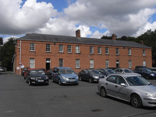
Detached two-storey former barracks, built c.1885, having nine-bay ground floor and eleven-bay first floor, with two full-height returns. Now in use as offices. Hipped natural slate roof with clay ridge tiles, moulded cast-iron guttering and cast-iron downpipes. Shouldered red brick chimneystacks. Guttering supported on stepped red brick eaves, supported on bracketed and sheeted overhanging eaves to south block with painted frieze below. Machine-made red brick walls laid in Flemish bond with chamfered red brick plinth course and continuous impost moulding at first floor. Gauged brick segmental-headed window openings with granite sills and timber sliding sash windows with ogee horns and cylinder glass, six-over-six pane to first floor and nine-over-nine pane to ground floor. Gauged brick segmental-headed door openings with painted sheeted timber doors and three-pane over-lights opening onto granite steps.
This official record and map point do not grant access. Most recorded buildings are privately owned; view them only from public ground unless the owner allows entry.