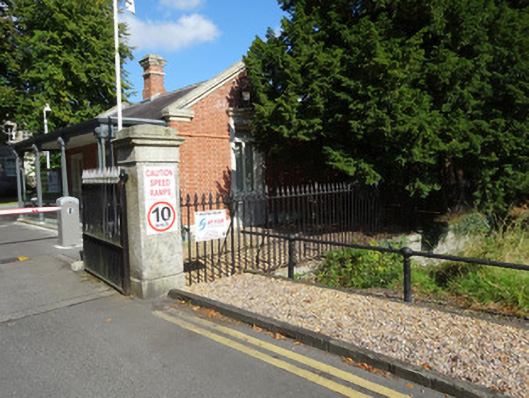
Add your own picture and explain the route, parking, gates, paths or landmarks that help people find it.
Earn 5 points after the picture is checked and accepted.
Add your photo and local directionsShare what you foundWhat is recorded here
Boundary walls and ha-ha ditch, built c.1725, encompassing former Mountjoy House, now Ordnance Survey of Ireland complex. Battered random-coursed rubble retaining wall with outer ditch surrounding oval enclosure. Localised areas of collapse. Wall supports variety of plant life. Entrance to complex from Ordnance Survey Road via stone gate piers and entrance gates of c.1840. Square-plan cut-stone granite piers supporting wrought-iron gates with cast-iron spearhead finials. Pedestrian gate to south with flat-panelled cast-iron gate pier. Wrought-iron railings on granite plinth walls to north and south of entrance gate..
This official record and map point do not grant access. Most recorded buildings are privately owned; view them only from public ground unless the owner allows entry.